Cumberland in Allegany County, Maryland — The American Northeast (Mid-Atlantic)
The Narrows
An Easier Route for the National Road
— The Historic National Road - The Road That Built The Nation —
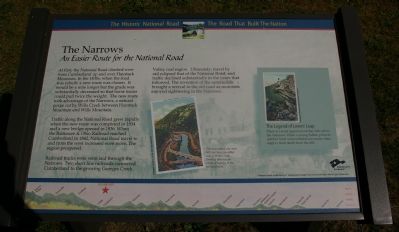
Traffic along the National Road grew rapidly when the new route was completed in 1834 and a new bridge opened in 1836. When the Baltimore & Ohio Railroad reached Cumberland in 1842, National Road travel to and from the west increased even more. The region prospered.
Railroad tracks were soon laid through the Narrows. Two short line railroads connected Cumberland to the growing Georges Creek Valley coal region. Ultimately, travel by rail eclipsed that of the National Road, and traffic declined substantially in the years that followed. The invention of the automobile brought a revival to the old road as motorists enjoyed sightseeing in the Narrows.
(Sidebar):
The Legend of Lovers’ Leap
There is a local legend about the cliffs above the Narrows. When a young Indian princess and her lover were forbidden to marry, they leapt to their death from the cliff.
Erected by America's Byways.
Topics and series. This historical marker is listed in this topic list: Roads & Vehicles. In addition, it is included in the The Historic National Road series list. A significant historical year for this entry is 1834.
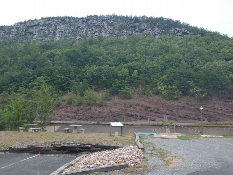
Location. This marker has been replaced by another marker nearby. It was located near 39° 39.776′ N, 78° 46.862′ W. Marker was in Cumberland, Maryland, in Allegany County. Marker was on National Highway (U.S. 40), on the right when traveling north. This is Wayside 45 on the Historic National Road in Maryland. Touch for map. Marker was at or near this postal address: 10307 National Highway, Cumberland MD 21502, United States of America. Touch for directions.
Other nearby markers. At least 8 other markers are within walking distance of this location. A different marker also named The Narrows (here, next to this marker); “The Narrows” (here, next to this marker); Site of Bridge 1834 (a few steps from this marker); a different marker also named The Narrows (about 400 feet away, measured in a direct line); To The Unknown Confederate Dead (approx. 0.6 miles away); Civil War Soldiers Monument (approx. 0.6 miles away); 617 Washington Street (approx. ¾ mile away); The First Iron Rails (approx. ¾ mile away). Touch for a list and map of all markers in Cumberland.
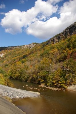
More about this marker. In the lower center is a reproduction of an old postcard showing, "The mountains rise over 800 feet here, on either side of Wills Creek, forming spectacular views of valleys to the east and west." In the side bar is another postcard showing Lovers' Leap. The background of the marker is "National Road at Fairview Inn" which is the standard for markers in this series. An elevation diagram of the national road is displayed on the bottom of the marker's face.
Related marker. Click here for another marker that is related to this marker. This marker has been replaced with the linked marker.
Also see . . . "The Cumberland Narrows: Portal to the Cumberland Road". Mountain Discoveries (Spring 2004) entry (Submitted on January 16, 2021, by Larry Gertner of New York, New York.)
Credits. This page was last revised on March 24, 2024. It was originally submitted on January 23, 2008, by Christopher Busta-Peck of Shaker Heights, Ohio. This page has been viewed 1,806 times since then and 44 times this year. Photos: 1. submitted on January 23, 2008, by Christopher Busta-Peck of Shaker Heights, Ohio. 2. submitted on August 7, 2022, by Craig Doda of Napoleon, Ohio. 3. submitted on January 23, 2008, by Christopher Busta-Peck of Shaker Heights, Ohio. • Craig Swain was the editor who published this page.


