Hilton Head Island in Beaufort County, South Carolina — The American South (South Atlantic)
Fort Howell
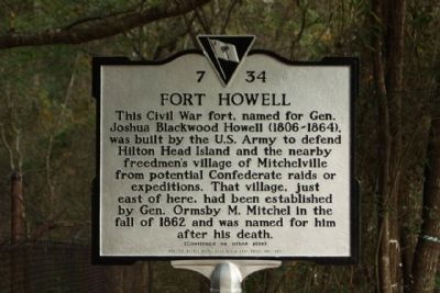
This Civil War fort, named for Gen. Joshua Blackwood Howell (1806-1864), was built by the U.S. Army to defend Hilton Head Island and the nearby freedmen’s village of Mitchelville from potential Confederate raids or expeditions. That village, just east of here, had been established by Gen. Ormsby M. Mitchel in the fall of 1862 and was named for him after his death.
(Reverse text)
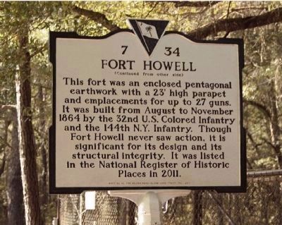
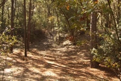
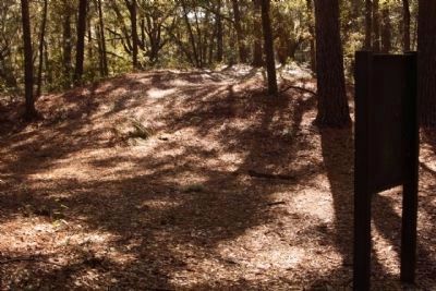
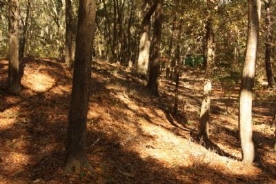
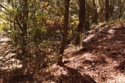
This fort was an enclosed pentagonal earthwork with a 23’ high parapet and emplacements for up to 27 guns. It was built from August to November 1864 by the 32nd U.S. Colored Infantry and the 144th N.Y. Infantry. Though Fort Howell never saw action, it is significant for its design and its structural integrity. It was listed in the National Register of Historic Places in 2011.
Erected 2011 by The Hilton Head Island Land Trust, Inc. (Marker Number 7-34.)
Topics. This historical marker is listed in these topic lists: Forts and Castles • War, US Civil. A significant historical month for this entry is November 1864.
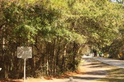
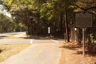
Location. 32° 14.056′ N, 80° 41.526′ W. Marker is on Hilton Head Island, South Carolina, in Beaufort County. Marker is on Beach City Road near Dillon Road, on the left when traveling north. Touch for map. Marker is in this post office area: Hilton Head Island SC 29926, United States of America. Touch for directions.
Other nearby markers. At least 8 other markers are within walking distance of this marker. Fort Howell - 1864 (here, next to this marker); Mitchelville Site (within shouting distance of this marker); St. James Baptist Church (within shouting distance of this marker); Cherry Hill School (about 300 feet away, measured in a direct line); Forts of the Civil War Era (approx. 0.2 miles away); General Howell / Captain Suter (approx. 0.2 miles away); The Troops that Built Fort Howell / Camp Baird (approx. 0.2 miles away); The Story of Fort Howell (approx. 0.2 miles away). Touch for a list and map of all markers in Hilton Head Island.
Regarding Fort Howell. Fort Howell, a Civil War earthwork fortification constructed in 1864, is significant in military history for its role in the Federal occupation and defense of Hilton Head Island; for its association with United States Colored Troops and the role they played in the occupation and defense of the island, and particularly in the construction of this fort; and for its association with Mitchelville, the nearby freedmen’s village it was built to defend, a settlement which had been established on Hilton Head Island in 1862-63. The fort is also significant for its engineering, as a rare, sophisticated, and particularly intact example of a large semi-permanent field fortification, designed by Captain Charles R. Suter, Chief of Engineers, Department of the South, U.S. Army. The fort was constructed from late August or early September to late November 1864 by the 32nd U.S. Colored Infantry and the 144th New York Infantry. It was designed to be manned by artillerymen serving a variety of garrison, siege or “seacoast” artillery pieces. Intended to protect the approaches to the nearby freedmen’s village of Mitchelville, it was constructed on an open site just southwest of the settlement, likely on a recently-logged site or a fallow cotton field. The fort, an essentially pentagonal enclosure constructed of built-up earth, is quite discernible despite natural erosion and the growth of trees and other vegetation over a period of almost 150 years. Its construction is typical of earthen Civil War fortifications, but the size, sophistication of design, and physical integrity of this fort are all exceptional in the context of surviving Civil War fortifications in South Carolina. Most large earthwork structures and lines of earthworks in the state, whether constructed by Federal or Confederate troops and whether intended as temporary works or semi-permanent ones, have much less integrity than Fort Howell does.
Listed in the National Register June 15, 2011.(South Carolina Department of Archives and History)
Also see . . .
1. Joshua B. Howell.
Colonel Howell died in the field hospital of the 85th Pennsylvania on September 14, 1864, three days after his 58th birthday. He was posthumously promoted to brigadier general, backdated to September 13, 1864 (Submitted on November 26, 2011, by Mike Stroud of Bluffton, South Carolina.)
2. New York State Division of Military and Naval Affairs: Military History. 144th Infantry Regiment Civil War Mustered in: September 27, 1862 Mustered out: June 25, 1865 (Submitted on November 26, 2011, by Mike Stroud of Bluffton, South Carolina.)
3. 32nd Regiment. United States Colored Regiment The regiment was ordered to duty in the Department of the South, and arrived at Hilton Head on the 27th of April. (Submitted on November 26, 2011, by Mike Stroud of Bluffton, South Carolina.)
Photographed By Mike Stroud, November 17, 2011
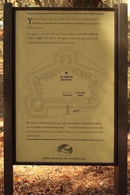
5. Fort Howell "Traverse"
You are standing on what was the fort's "Traverse," or " Bomb-Proof," a 50 foot long earthwork which protected troops inside from enemy assults on the forts entrance. Pentagonal in shape, the earthworks measured approximenately 525' by 400' and reached a height of 23'. Four 5' x 8' magazines, which were protected by earth mounds, housed powder and shot for up to 27 guns.
(Lower text) The exterior of the fort featured a moat and wooden palisades - sharpened logs driven into the ground to slow advancing troops. The area directly adjacent to the fort walls was further protected by guns mounted in " bastions," an example of which at the end of this path.
(Lower text) The exterior of the fort featured a moat and wooden palisades - sharpened logs driven into the ground to slow advancing troops. The area directly adjacent to the fort walls was further protected by guns mounted in " bastions," an example of which at the end of this path.
Credits. This page was last revised on June 16, 2016. It was originally submitted on November 26, 2011, by Mike Stroud of Bluffton, South Carolina. This page has been viewed 1,620 times since then and 91 times this year. Photos: 1, 2, 3, 4, 5, 6, 7, 8, 9. submitted on November 28, 2011, by Mike Stroud of Bluffton, South Carolina.
