Poplar Springs in Howard County, Maryland — The American Northeast (Mid-Atlantic)
Poplar Springs
"From Drovers to Drivers"
— The Historic National Road - The Road That Built The Nation —
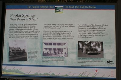
In the early 1800s, as settlers spread west from the Chesapeake Bay, the farming community of Poplar Springs grew up around the Baltimore and Frederick-Town Turnpike, part of the system of roads making up the National Road. An endless parade of drovers and teamsters were just a two-day ride from Baltimore, known at that time as the “Monument City.” They were driving their geese, sheep, cattle, pigs and freight wagons east and west, to and from the busy port on “a smooth way.”
Catering to new generations traveling in automobiles, the Poplar Springs tourist facility was built in 1920. Travel writer Robert Bruce noted in 1916 that “Now and then we pass an old, low, square signpost “_M to Baltimore,” the figures and letters often difficult to decipher at speed. Prosperous farms line both sides of the road...most of the houses are painted white...This seems to be a fashion throughout Central Maryland... and adds to the attractiveness of the country in spring and summer.”
Erected by America's Byways.
Topics and series. This historical marker is listed in this topic list: Roads & Vehicles. In addition, it is included in the The Historic National Road series list. A significant historical year for this entry is 1920.
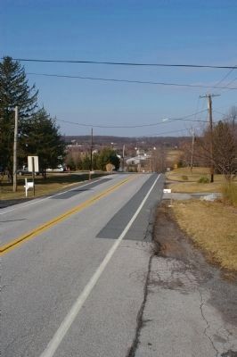
Location. 39° 20.74′ N, 77° 6.376′ W. Marker is in Poplar Springs, Maryland, in Howard County. Marker is on Frederick Road (Maryland Route 144), on the right when traveling west. Touch for map. Marker is at or near this postal address: 17004 Frederick Rd, Poplar Springs, Maryland, Mount Airy MD 21771, United States of America. Touch for directions.
Other nearby markers. At least 8 other markers are within 4 miles of this marker, measured as the crow flies. Simpson & Mount Gregory United Methodist Churches (approx. 0.6 miles away); New Lisbon (approx. 2.1 miles away); Parrsville & Ridgeville (approx. 3.2 miles away); Railway Express Agency Baggage Wagon (approx. 3.3 miles away); Riddlemoser Building (approx. 3.3 miles away); Bobsled (approx. 3.3 miles away); Sledding in Mount Airy in the Past (approx. 3.4 miles away); The Condon Building (approx. 3.4 miles away).
More about this marker. On the left a photograph is captioned, "For 80 years, a traveler stopping at old Poplar Springs Hotel could get a wheel or piece of harness fixed along with 'fine food and lodging for man and horse.'"
In the lower center a photograph shows, "In 1937, John and Virginia Haines stand proudly in front of their “new” Poplar Springs facility which featured dining with live entertainment and three tourist cabins."
On the lower right, "Virginia Haines and “Sis” Richard pose with a shiny family sedan in front of their tourist cabins in 1951. Post World War II prosperity soon replaced cabins with the motel industry."
The background of the marker is "National Road at Fairview Inn" which is the standard for markers in this series. An elevation diagram of the national road is displayed on the bottom of the marker's face.
Also see . . . Poplar Springs, Maryland. Wikipedia entry (Submitted on March 13, 2022, by Larry Gertner of New York, New York.)
Credits. This page was last revised on March 24, 2024. It was originally submitted on January 27, 2008, by Christopher Busta-Peck of Shaker Heights, Ohio. This page has been viewed 2,360 times since then and 50 times this year. Photos: 1. submitted on February 9, 2008, by Christopher Busta-Peck of Shaker Heights, Ohio. 2. submitted on January 27, 2008, by Christopher Busta-Peck of Shaker Heights, Ohio. 3, 4. submitted on March 10, 2008, by Christopher Busta-Peck of Shaker Heights, Ohio. • Craig Swain was the editor who published this page.


