SpanishTown
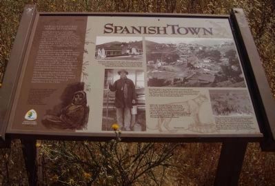
Established in December, 1845, Spanishtown developed as Indians, Californios and immigrants from Peru, Argentina and Mexico built their homes on the hill above Deep Gulch. Cinnabar was first mined from a nearby cave known to local Indians. Later in 150, Mine Hill’s Main Tunnel was built about 200 feet below this cave.
As Spanishtown grew, the Catholic Church, general store and boarding houses occupied the top of the hill. All buildings were company-owned though many families embellished their cottages with white fences, vegetable and flower gardens. Where space would allow, yards also contained chickens, a cow mule or burro. Less fortunate homes clung to rocky slopes, accessible only by a narrow footpath. The town was abandoned about 1912 when the Quicksilver Mining Company entered bankruptcy. The Army Corps of Engineers removed most traces of Spanishtown in the 1930s.
[Illustration caption:]
Mexican Camp Girl – “A little girl named Amelia, too-slight and small to carry the child she had wrapped in an old shawl stood beside me and told me the Spanish words for rock, sky and picture and the names of her brothers and sisters.” (Mary Hallock Foote’s A California Mining Camp)
Photo captions: top left]
Home of a Mexican Miner, 1885 – these redwood dwellings are typical of homes that accommodated
[top right]
Spanishtown – Deep Gulch, to the left, is situated at the base of Mine Hill. The Catholic Church is at the upper center. Early inhabitants were workers transported from Mexico by Barron, Forbes and Company. “The Mexicans knew how to find cinnabar, and the Cornish new how to bring it out.” (Jimmie Schneider’s Quicksilver)
[bottom left]
Hispanic Miner – Patricio Avila showing off his tools. A miner’s lamp fed with whale oil (also called a teapot lamp) hung on his coat. Ready to descend into the mine, Patricio carried a drill, lunch bucket and water bucket. He dressed in layers, effectively carrying his clothing to accommodate changers in temperature between the surface and inside the mine. (Photograph 1890 by Robert Bulmore)
[bottom right]
Colgate de Judas – Each year Mexicans paraded an effigy of Judas through Spanishtown, ending at the platform near St. Anthony’s Catholic Church (upper left). After the crowd gathered around, they strung up the effigy, filling with it fireworks and a cat. The fireworks were lit and the frightened cat released, symbolizing the release of Judas’ soul. (Bulmore Photo)
Erected by Santa Clara County Parks
Topics. This historical marker is listed in these topic lists: Hispanic Americans • Industry & Commerce. A significant historical month for this entry is December 1845.
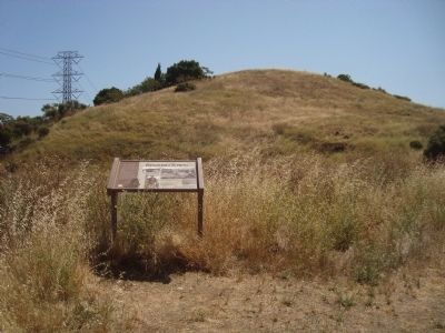
Location. 37° 10.397′ N, 121° 50.517′ W. Marker is in San Jose, California, in Santa Clara County. It is in Almaden. Marker can be reached from Hicks Road. This marker is located in Almaden Quicksilver County Park on the Hidalgo Cemetery Trail near the junction with the Yellow Kid Trail. Touch for map. Marker is in this post office area: San Jose CA 95120, United States of America. Touch for directions.
Other nearby markers. At least 8 other markers are within walking distance of this marker. Mine Hill (approx. 0.2 miles away); The Rossi Retort (approx. 0.2 miles away); The “Main Tunnel” (approx. ¼ mile away); The Yellow Kid (approx. 0.3 miles away); English Camp (approx. 0.4 miles away); English Camp School (approx. 0.4 miles away); Site of English Town (approx. 0.4 miles away); Camp Mt. Madonna (approx. 0.4 miles away). Touch for a list and map of all markers in San Jose.
Credits. This page was last revised on February 7, 2023. It was originally submitted on December 19, 2011, by Barry Swackhamer of Brentwood, California. This page has been viewed 926 times since then and 49 times this year. Photos: 1, 2. submitted on December 19, 2011, by Barry Swackhamer of Brentwood, California. • Bill Pfingsten was the editor who published this page.

