San Diego in San Diego County, California — The American West (Pacific Coastal)
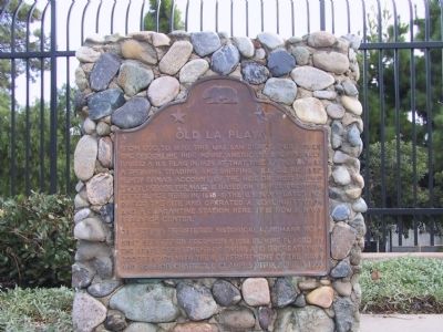
Old La Playa
Erected 1989 by State Department of Parks and Recreation in cooperation with the U.S. Department of the Navy and Squibob Chapter, E Clampus Vitus. (Marker Number 61.)
Topics and series. This historical marker is listed in these topic lists: Industry & Commerce • Notable Places • Waterways & Vessels. In addition, it is included in the California Historical Landmarks, and the E Clampus Vitus series lists. A significant historical year for this entry is 1770.
Location. 32° 42.275′ N, 117° 14.337′ W. Marker is in San Diego, California, in San Diego County. Marker is at the intersection of Rosecrans Street and Gate Road, on the right when traveling north on Rosecrans Street. Marker is located at the entrance to the Military Reserve. Touch for map. Marker is at or near this postal address: 297 Rosecrans Street, San Diego CA 92106, United States of America. Touch for directions.
Other nearby markers. At least 8 other markers are within 2 miles of this marker, measured as the crow flies. In Memory of the Heroes of the Battle of San Pasqual (approx. 1.1 miles away); In Memory of the Mormon Battalion (approx. 1.1 miles away); Chinese Fishing and Shipbuilding Site (approx. 1.1 miles away); Fort Rosecrans National Cemetery (approx. 1.2 miles away); First Holy Mass Celebrated in California (approx. 1.2 miles away); Post Chapel, Building 213 (approx. 1.2 miles away); Moreton Bay Fig (approx. 1.4 miles away); USS Hoel * USS S. B. Roberts * USS Johnston (approx. 1.4 miles away). Touch for a list and map of all markers in San Diego.
Credits. This page was last revised on June 16, 2016. It was originally submitted on December 29, 2011, by Michael Kindig of Elk Grove, California. This page has been viewed 580 times since then and 19 times this year. Photo 1. submitted on December 30, 2011, by Michael Kindig of Elk Grove, California. • Syd Whittle was the editor who published this page.
