Columbia Island in Southwest Washington in Washington, District of Columbia — The American Northeast (Mid-Atlantic)
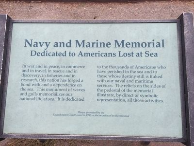
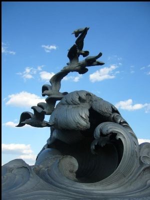
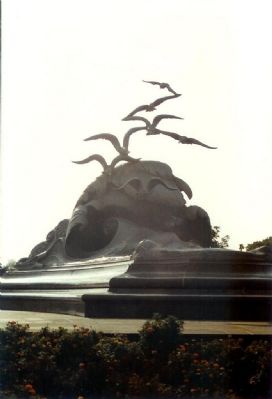
Navy and Marine Memorial
Dedicated to Americans Lost at Sea
Erected 1990 by United States Coast Guard on the Occasion of its Bicentennial.
Topics and series. This historical marker and memorial is listed in these topic lists: Disasters • Waterways & Vessels. In addition, it is included in the Lost at Sea series list.
Location. 38° 52.567′ N, 77° 2.85′ W. Marker is in Southwest Washington in Washington, District of Columbia. It is on Columbia Island. Marker can be reached from Mount Vernon Trail, 0.1 miles west of 14th Street Bridge (Interstate 395), on the right when traveling north. Touch for map. Marker is in this post office area: Washington DC 20037, United States of America. Touch for directions.
Other nearby markers. At least 8 other markers are within walking distance of this marker. The Memorial Grove (approx. ¼ mile away); "Where flowers bloom, so does hope" (approx. 0.4 miles away); Architect of the Great Society (approx. 0.4 miles away); Air Mail (approx. 0.4 miles away); Fort Runyon (approx. half a mile away in Virginia); George Mason (approx. half a mile away); River Bottom to Parkland (approx. half a mile away); Forgotten Founder (approx. half a mile away). Touch for a list and map of all markers in Southwest Washington.
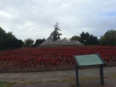
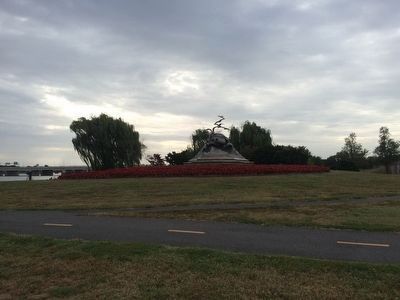
More about this memorial. This marker is located in Lady Bird Johnson Park. It is on the west bank of the Potomac River, opposite the Tidal Basin of southwest Washington, DC and immediately northwest of the intersection of the George Washington Parkway and I-395/US1.
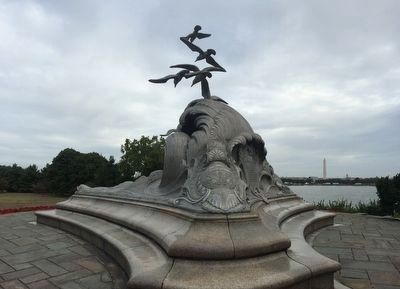
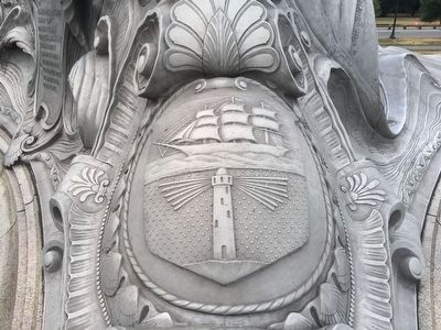
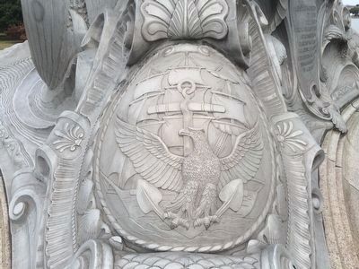
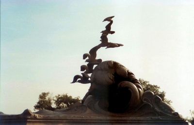
Regarding Navy and Marine Memorial. This marker plaque re-dedicates the memorial designed by architect Harvey Corbett with the "Waves and Gulls" sculpture created by Ernesto Begni del Piatta, originally commissioned by the Navy-Marine Memorial Association in 1924 and erected on public grounds in the city of Washington, D.C. on October 18, 1934.
Initially intended to commemorate Americans
who served at sea during the First World War, emphasis was placed on those of the U.S. Navy (into which the U.S. Coast Guard was incorporated during wartime) and the U.S. Merchant Marine who lost their lives. That focus was expanded by the Coast Guard in 1990 to recognize American seafarers in general.
While "Seafarer's Memorial" would seem a more appropriate name (being inclusive even of members of the U.S. Marine Corps who died at sea), the "Navy-Marine" title has persisted and has itself often corrupted into "Navy-Marine Corps" in official references. In any case, the magnificent aluminum sculpture of seagulls and waves is arguably the most beautiful piece of outdoor art in the National Capital Region.
Also see . . . Navy-Marine Memorial. (Submitted on February 3, 2008, by Richard E. Miller of Oxon Hill, Maryland.)
Additional keywords. Merchant Marine, Coast Guard, George Washington Parkway
Photographed By Richard E. Miller, November 13, 2006
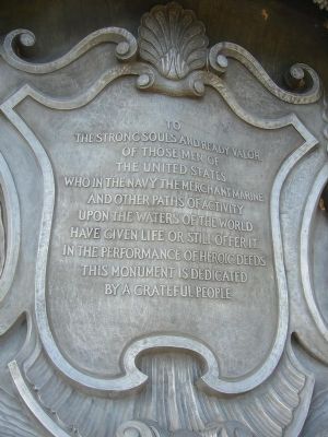
3. The Original Dedication, 1934
"To the strong souls and ready valor of those men of the United States who in the Navy, Merchant Marine and other paths of activity upon the waters of the world have given life or still offer it in the performance of heroic deeds, this monument is dedicated by a grateful people."
Credits. This page was last revised on January 31, 2023. It was originally submitted on February 3, 2008, by Richard E. Miller of Oxon Hill, Maryland. This page has been viewed 2,059 times since then and 14 times this year. Photos: 1, 2. submitted on September 27, 2015, by J. Makali Bruton of Accra, Ghana. 3. submitted on February 3, 2008, by Richard E. Miller of Oxon Hill, Maryland. 4, 5. submitted on September 27, 2015, by J. Makali Bruton of Accra, Ghana. 6. submitted on February 3, 2008, by Richard E. Miller of Oxon Hill, Maryland. 7, 8. submitted on September 27, 2015, by J. Makali Bruton of Accra, Ghana. 9, 10. submitted on February 4, 2008, by Mike Stroud of Bluffton, South Carolina. • Kevin W. was the editor who published this page.
