Marigny in New Orleans in Orleans Parish, Louisiana — The American South (West South Central)
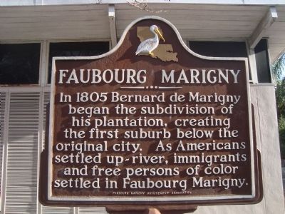
Fauboug Marigny
Erected by Faubourg Marigny Improvement Association.
Topics. This historical marker is listed in these topic lists: African Americans • Agriculture • Settlements & Settlers. A significant historical year for this entry is 1805.
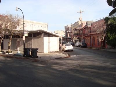
Location. 29° 57.726′ N, 90° 3.466′ W. Marker is in New Orleans, Louisiana, in Orleans Parish. It is in Marigny. Marker is at the intersection of Esplanade Avenue and Frenchmen Street on Esplanade Avenue. Touch for map. Marker is at or near this postal address: 449 Esplanade Avenue, New Orleans LA 70116, United States of America. Touch for directions.
Other nearby markers. At least 8 other markers are within walking distance of this marker. Sicilian Jazz / Sicilian Swing & Rock n’ Roll (within shouting distance of this marker); United States Mint (within shouting distance of this marker); Fort St. Charles (about 300 feet away, measured in a direct line); Solomon Northup (about 400 feet away); New Orleans and the Domestic Slave Trade (about 500 feet away); Denis House (about 500 feet away); Bringier – Barnett House (about 600 feet away); The Lamothe House (about 600 feet away). Touch for a list and map of all markers in New Orleans.
Also see . . . Bernard de Marigny - Wikipedia. (Submitted on January 13, 2012, by Barry Swackhamer of Brentwood, California.)
Credits. This page was last revised on February 12, 2023. It was originally submitted on January 13, 2012, by Barry Swackhamer of Brentwood, California. This page has been viewed 1,118 times since then and 42 times this year. Photos: 1, 2, 3, 4. submitted on January 13, 2012, by Barry Swackhamer of Brentwood, California. • Craig Swain was the editor who published this page.


