South San Jose in Santa Clara County, California — The American West (Pacific Coastal)
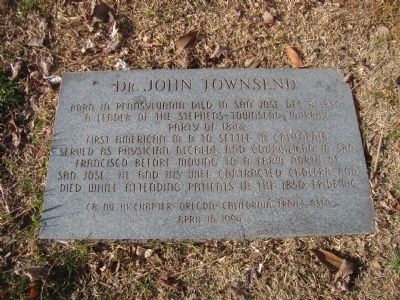
Dr. John Townsend
Dec. 8, 1850
A leader of the Stephens-Townsend-Murphy
Party of 1844
Served as physician, alcalde, and councilman in San Francisco before moving to a farm north of San Jose. He and his wife contacted cholera and died while attending patients in the 1850 epidemic.
Erected 1994 by CA NV HI Chapter Oregon-California Trails Assn.
Topics. This historical marker is listed in these topic lists: Cemeteries & Burial Sites • Settlements & Settlers. A significant historical month for this entry is December 1946.
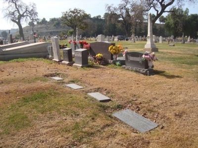
Location. 37° 17.867′ N, 121° 51.428′ W. Marker is in San Jose, California, in Santa Clara County. It is in South San Jose. Marker is on Curtner Avenue, on the right when traveling south. This marker is located on the northern edge, next to "Oak Hill Avenue", of the Pioneer Section in Oak Hill Cemetery. The cemetery is located at the intersection of Curtner Avenue and Monterey Highway (State Route 82). Touch for map. Marker is at or near this postal address: 300 Curtner Avenue, San Jose CA 95125, United States of America. Touch for directions.
Other nearby markers. At least 8 other markers are within walking distance of this marker. George Donner, Jr. (within shouting distance of this marker); Jean Jacques Vioget (within shouting distance of this marker); William Henry Eddy (about 300 feet away, measured in a direct line); Dr. Louis H. and Anna M. (Grandma) Bascom (about 600 feet away); Montgomery Maze (about 800 feet away); Margaret Caldwell Fox (approx. 0.2 miles away); Charles Henry McKiernan (approx. 0.3 miles away); History of Vieira Park (approx. ¾ mile away). Touch for a list and map of all markers in San Jose.
Related markers. Click here for a list of markers that are related to this marker. Additional markers commemorating the Stephens-Townsend-Murphy Party
Additional keywords. Stephen-Townsend-Murphy Party
Credits. This page was last revised on February 7, 2023. It was originally submitted on February 4, 2012, by Barry Swackhamer of Brentwood, California. This page has been viewed 772 times since then and 22 times this year. Photos: 1, 2. submitted on February 4, 2012, by Barry Swackhamer of Brentwood, California. • Syd Whittle was the editor who published this page.

