Logan Township near Altoona in Blair County, Pennsylvania — The American Northeast (Mid-Atlantic)
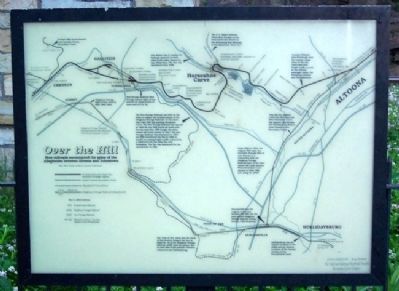
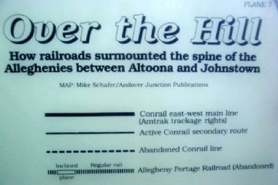
Over the Hill
How railroads surmounted the spine of the Alleghenies
— between Altoona and Johnstown —
This was the original (1850-54) PRR main line. After Horseshoe Curve was opened, this became the Hollidaysburg Branch (now Conrail's Cove Secondary Track).
From 1850 to 1854, the original PRR main line extended through what is now Altoona to a connection with the Allegheny Portage Railroad (part of the state-owned rail/canal system). When Horseshoe Curve opened in 1854, PRR quit using the APRR.
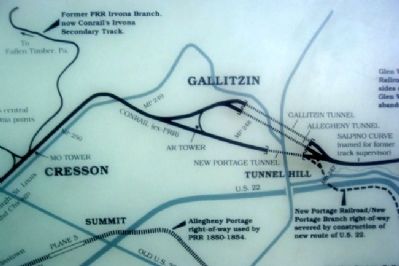
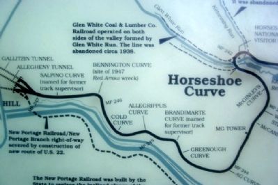
The New Portage Railroad was built by the State to replace the inclined planes of the Alegheny Portage Railroad - at the same time that PRR was building Horseshoe Curve. The New Portage Railroad was opened in 1855-56, but PRR routed all trains over its own main line. PRR bought the state-owned rail/canal system in 1857. The New Portage Railroad was abandoned in 1857, but PRR reactivated the line in 1904 to handle increasing freight traffic and provide a relief route for the main line over Horseshoe. The line was abandoned for the second time in 1981.
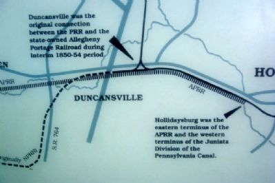
Duncansville was the original connection between the PRR and the state-owned Allegheny Portage Railroad during interim 1850-54 period.
Hollidaysburg was the eastern terminus of the APRR and the western terminus of the Juniata Division of the Pennsylvania Canal.
Former PRR Irvona Branch, now Conrail's Irvona Secondary Track.
New Portage Railroad/New Portage Branch right-of-way severed by construction of new route of U.S. 22.
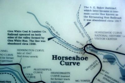
The S. E. Baker Railroad, which later became a common-carrier line known as the Kittanning Run Railroad; it was abandoned circa 1917.
Glen White Coal & Lumber Co. Railroad operated on both sides of the valley formed by Glen White Run. The line was abandoned circa 1938.
Conrail's Philadelphia-Pittsburgh main line carries a large share of the railroad's east-west freight traffic as well as two Amtrak passenger trains the Broadway Limited and Pennsylvanian.
Topics and series. This historical marker is listed in these topic lists: Industry & Commerce • Man-Made Features • Railroads & Streetcars. In addition, it is included in the Pennsylvania Railroad (PRR) series list. A significant historical year for this entry is 1850.
Location. 40° 29.874′ N, 78° 29.149′ W. Marker is near Altoona, Pennsylvania, in Blair County. It is in Logan Township. Marker can be reached from Veterans Memorial Highway. Marker is at the Horseshoe Curve viewing area, off Veterans Memorial Highway / Burgoon Road. Touch for map. Marker is at or near this postal address: 2400 Veterans Memorial Hwy, Altoona PA 16601, United States of America. Touch for directions.
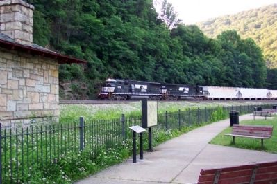
Other nearby markers. At least 8 other markers are within 4 miles of this marker, measured as the crow flies. Trackside Buildings (here, next to this marker); The GP9 (within shouting distance of this
marker); Watching The Curve (within shouting distance of this marker); Horseshoe Curve (about 400 feet away, measured in a direct line); a different marker also named Horseshoe Curve (about 400 feet away); Blair County War Mothers Memorial (approx. 3.4 miles away); Blair County Memorial Highway (approx. 3.4 miles away); Endress War Memorial (approx. 3.4 miles away). Touch for a list and map of all markers in Altoona.
Also see . . .
1. Horseshoe Curve. Wikipedia entry (Submitted on February 11, 2012, by William Fischer, Jr. of Scranton, Pennsylvania.)
2. World Famous Horseshoe Curve. Railroaders Memorial Museum website entry (Submitted on February 11, 2012, by William Fischer, Jr. of Scranton, Pennsylvania.)
Credits. This page was last revised on November 12, 2023. It was originally submitted on February 11, 2012, by William Fischer, Jr. of Scranton, Pennsylvania. This page has been viewed 1,438 times since then and 83 times this year. Photos: 1, 2, 3, 4, 5, 6, 7, 8. submitted on February 11, 2012, by William Fischer, Jr. of Scranton, Pennsylvania.
