Johnstown in Cambria County, Pennsylvania — The American Northeast (Mid-Atlantic)
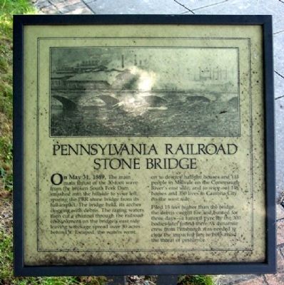
Pennsylvania Railroad Stone Bridge
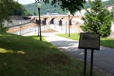
On May 31, 1889, The main main [sic] thrust of the 30-foot wave from the broken South Fork Dam smashed into the hillside to your left, sparing the PRR stone bridge from its full impact. The bridge held, its arches clogged with debris. The raging waters then cut a channel through the railroad embankment on the bridge's east side leaving wreckage spread over 30 acres behind it. Escaped, the waters went on to destroy half the houses and 115 people in Millvale on the Conemaugh River's east side, and to wipe out 148 homes and 350 lives in Cambria City on the west side.
Piled 15 feet higher than the bridge the debris caught fire and burned for three days - a funeral pyre for the 300 bodies later found there. A dynamite crew from Pittsburgh was needed to clear the impacted jam to help avoid the threat of pestilence.
Topics. This historical marker is listed in these topic lists: Bridges & Viaducts • Disasters • Railroads & Streetcars • Waterways & Vessels. A significant historical month for this entry is May 2003.
Location. 40° 19.811′ N, 78° 55.495′ W. Marker is in Johnstown, Pennsylvania, in Cambria County. Marker is in Point Park, off Washington Street, near the confluence of the Little Conemaugh and Stonycreek Rivers. Touch for map. Marker is in this post office area: Johnstown PA 15901, United States of America. Touch for directions.
Other nearby markers. At least 8 other markers are within walking distance of this marker. Flood Prevention (here, next to this marker); Johnstown Local Flood Protection Project (within shouting distance of this marker); A Success Story (within shouting distance of this marker); Johnstown Flood (about 400 feet away, measured in a direct line); American Red Cross (about 400 feet away); Johns Street Bridge (about 500 feet away); Main Street and Point Stadium Ramp (approx. 0.2 miles away); Rolling Mill Mine Disaster (approx. 0.2 miles away). Touch for a list and map of all markers in Johnstown.
Also see . . .
1. Johnstown Flood National Memorial. National Park Service website entry (Submitted on February 18, 2012, by William Fischer, Jr. of Scranton, Pennsylvania.)
2. History of the Johnstown Flood. Johnstown Area Heritage Association website entry (Submitted on February 18, 2012, by William Fischer, Jr. of Scranton, Pennsylvania.)
Credits. This page was last revised on July 20, 2023. It was originally submitted on February 18, 2012, by William Fischer, Jr. of Scranton, Pennsylvania. This page has been viewed 684 times since then and 24 times this year. Photos: 1, 2. submitted on February 18, 2012, by William Fischer, Jr. of Scranton, Pennsylvania.

