Huguenot in Orange County, New York — The American Northeast (Mid-Atlantic)
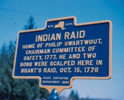
Indian Raid
Erected 1936 by State Education Department.
Topics. This historical marker is listed in these topic lists: Native Americans • War, US Revolutionary. A significant historical year for this entry is 1777.
Location. Marker has been reported missing. It was located near 41° 25.042′ N, 74° 37.851′ W. Marker was in Huguenot, New York, in Orange County. Marker was at the intersection of U.S. 209 and Swartwout Road, on the left when traveling north on U.S. 209. Touch for map. Marker was in this post office area: Huguenot NY 12746, United States of America. Touch for directions.
Other nearby markers. At least 8 other markers are within walking distance of this location. N.J. Line War (within shouting distance of this marker); a different marker also named Indian Raid (within shouting distance of this marker); Huguenot (within shouting distance of this marker); Deerpark 9/11 Memorial (about 300 feet away, measured in a direct line); a different marker also named Indian Raid (about 400 feet away); Westfall Fort (about 500 feet away); Huguenot School (approx. 0.2 miles away); Site of Home (approx. half a mile away). Touch for a list and map of all markers in Huguenot.
Credits. This page was last revised on January 29, 2023. It was originally submitted on February 28, 2012, by Bruce T. Crandall of Goshen, New York. This page has been viewed 669 times since then and 24 times this year. Photos: 1. submitted on February 28, 2012, by Bruce T. Crandall of Goshen, New York. 2. submitted on January 29, 2023, by William Fischer, Jr. of Scranton, Pennsylvania. • Bill Pfingsten was the editor who published this page.

