Moncks Corner in Berkeley County, South Carolina — The American South (South Atlantic)
Fairlawn Plantation / Fort Fairlawn
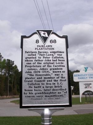
Fairlawn Plantation
Fairlawn Barony, sometimes called “Fair-Lawn,” was granted to Peter Colleton, whose father John had been one of the original Lords Proprietors of the Carolina colony. John’s grandson John (1679-1754), known as “The Honorable,” was a planter and member of the Grand Council and the first Colleton to live in S.C. He built a large brick house here, later described by his granddaughter as “of course very magnificent.”
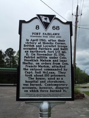
Fort Fairlawn
In April 1780, after their victory at Moncks Corner, British and Loyalist troops occupied Fairlawn and built an earthwork fort 1/2 mi. E. On November 17, 1781, Patriot militia under Cols. Hezekiah Maham and Isaac Shelby, on orders from Gen. Francis Marion, attacked the outpost commanded by Capt. Neil McLean. They took about 150 prisoners. The house, used as a hospital and storehouse, was burned. Contemporary accounts, however, disagree on which force burned it.
Erected 2011 by Berkeley County Historical Society and the General Marion’s Brigade Chapter, Daughters of the American Revolution. (Marker Number 8-68.)
Topics and series. This historical marker is listed in these topic lists: Colonial Era • War, US Revolutionary
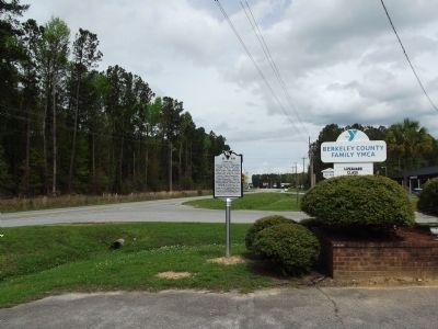
Location. 33° 11.341′ N, 79° 59.524′ W. Marker is in Moncks Corner, South Carolina, in Berkeley County. Marker is on Rembert C Dennis Blvd. near Edward Drive, on the right when traveling north. Touch for map. Marker is in this post office area: Moncks Corner SC 29461, United States of America. Touch for directions.
Other nearby markers. At least 8 other markers are within one mile of this marker, measured as the crow flies. Dixie Training School / Berkeley Training High School (approx. 0.3 miles away); Rembert C. Dennis Boulevard (approx. 0.4 miles away); Stony Landing Plantation (approx. 0.6 miles away); Moncks Corner Depot (approx. 0.8 miles away); Berkeley Training High School (approx. 0.8 miles away); Old Moncks Corner (approx. 0.9 miles away); First Site of Moncks Corner (approx. one mile away); Santee Canal (approx. 1.1 miles away). Touch for a list and map of all markers in Moncks Corner.
Credits. This page was last revised on June 16, 2016. It was originally submitted on March 25, 2012, by Anna Inbody of Columbia, South Carolina. This page has been viewed 2,873 times since then and 279 times this year. Photos: 1, 2, 3. submitted on March 25, 2012, by Anna Inbody of Columbia, South Carolina. • Bill Pfingsten was the editor who published this page.


