Bethune in Kershaw County, South Carolina — The American South (South Atlantic)
Tiller's Ferry
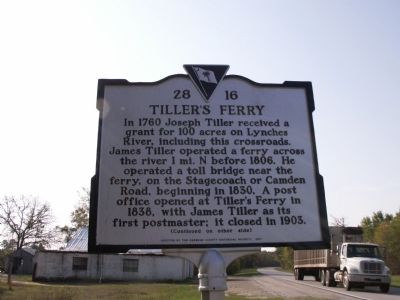
In 1760 Joseph Tiller received a grant for 100 acres on Lynches River, including this crossroads. James Tiller operated a ferry across the river 1 mi. N before 1806. He operated a toll bridge near the ferry, on the Stagecoach or Camden Road, beginning in 1830. A post office opened at Tillerís Ferry in 1838, with James Tiller as its first postmaster; it closed in 1903.
(Reverse)
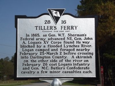
In 1865, as Gen. W.T. Shermanís Federal army advanced NE, Gen. John A. Loganís XV Corps found its way blocked by a flooded Lynches River. Logan camped and foraged nearby February 25-March 2 before crossing into Darlington County. A skirmish on the other side of the river on February 26 cost Loganís infantry and Gen. M.C. Butlerís Confederate cavalry a few minor casualties each.
Erected 2011 by The Kershaw County Historical Society. (Marker Number 28-16.)
Topics. This historical marker is listed in these topic lists: Bridges & Viaducts • War, US Civil. A significant historical date for this entry is February 25, 1914.
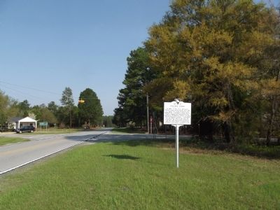
Location. 34° 21.784′ N, 80° 18.394′ W. Marker is in Bethune, South Carolina, in Kershaw County. Marker is at the intersection of State Highway 341 and Old Stagecoach Road (County Road 28-15), on the left when traveling south on State Highway 341. Touch for map. Marker is in this post office area: Bethune SC 29009, United States of America. Touch for directions.
Other nearby markers. At least 8 other markers are within 10 miles of this marker, measured as the crow flies. Pleasant Hill Baptist Church (approx. 2.7 miles away); Hall's Mill (approx. 7 miles away); Lower Fork Of Lynches Creek Baptist Church / Gum Branch Church (approx. 7 miles away); Seaboard Air Line Railway Depot (approx. 7.9 miles away); Captain Peter DuBose (approx. 9.4 miles away); Jacob Kelley House (approx. 9.4 miles away); West's Crossroads / Donald H. Holland House (approx. 9.7 miles away); Cash-Shannon Duel (approx. 9.7 miles away).
Credits. This page was last revised on June 16, 2016. It was originally submitted on March 29, 2012, by Anna Inbody of Columbia, South Carolina. This page has been viewed 1,783 times since then and 151 times this year. Photos: 1, 2, 3. submitted on March 29, 2012, by Anna Inbody of Columbia, South Carolina. • Craig Swain was the editor who published this page.


