Near Rome in Oneida County, New York — The American Northeast (Mid-Atlantic)
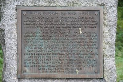
Historic Lower Landing Place
Here, Aug. 2, 1777, Lieut. Henry Bird, commanding St. Leger's advance guard composed of 30 regulars and a party of Indians under Joseph Brant, established the first camp of the British investment of Fort Stanwix. This was attacked and looted, Aug. 6, by Lt. Col. Marinus Willett and 250 continental troops.
Capt. Lernoult and 110 British regulars then erected here a fortified camp with two small cannon and held it for the remainder of the siege.
Here also was the lock, the starting point for the first canal connecting the waters of the Mohawk and Wood Creek, commenced by the Western Inland Lock & Navigation Co., in 1792.
Erected 1928 by New York State Historical Marker.
Topics. This historical marker is listed in these topic lists: Industry & Commerce • War, US Revolutionary • Waterways & Vessels. A significant historical date for this entry is August 2, 1777.
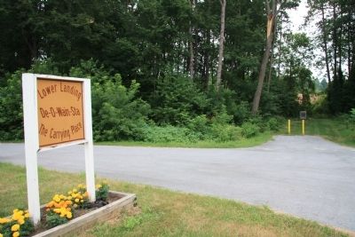
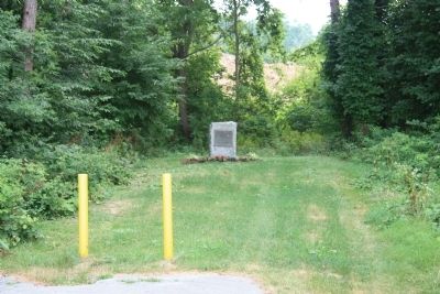
Location. 43° 11.924′ N, 75° 26.687′ W. Marker is near Rome, New York, in Oneida County. Marker is on Martin Street east of Erie Boulevard East (New York State Route 26), on the left when traveling east. The historical marker is located at a roadside park, that is marked with a sign that states, "Lower Landing, De-O-Wain-Sta, The Carrying Place.". Touch for map. Marker is in this post office area: Rome NY 13440, United States of America. Touch for directions.
Other nearby markers. At least 8 other markers are within walking distance of this marker. Upper Landing Place (approx. 0.6 miles away); Fort Craven (approx. 0.6 miles away); Willett Bridge (approx. ¾ mile away); Fort Williams (approx. ¾ mile away); Revolutionary Battlefields (approx. 0.9 miles away); During the siege of Fort Stanwix Aug. 1777 (approx. 0.9 miles away); Rome's Italian Heritage (approx. 0.9 miles away); Their voices heard... (approx. 0.9 miles away). Touch for a list and map of all markers in Rome.
Credits. This page was last revised on June 16, 2016. It was originally submitted on April 5, 2012, by Dale K. Benington of Toledo, Ohio. This page has been viewed 592 times since then and 24 times this year. Photos: 1, 2, 3, 4, 5. submitted on April 5, 2012, by Dale K. Benington of Toledo, Ohio.


