Herkimer in Herkimer County, New York — The American Northeast (Mid-Atlantic)
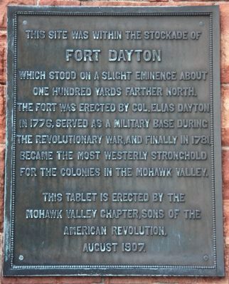
Fort Dayton
Fort Dayton
which stood on a slight eminence about
one hundred yards farther north.
The fort was erected by Col. Elias Dayton
in 1776, served as a military base during
the Revolutionary War, and finally in 1781,
became the most westerly stronghold
for the colonies in the Mohawk Valley.
Erected 1907 by The Mohawk Valley Chapter, Sons of the American Revolution.
Topics and series. This historical marker is listed in these topic lists: Colonial Era • Forts and Castles • War, US Revolutionary. In addition, it is included in the Sons of the American Revolution (SAR) series list. A significant historical year for this entry is 1776.
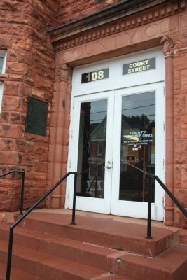
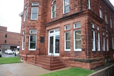
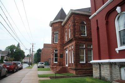
Location. 43° 1.764′ N, 74° 59.328′ W. Marker is in Herkimer, New York, in Herkimer County. Marker is on Court Street east of North Main Street, on the right when traveling east. This historical marker is affixed to the outside wall of a red stone building where the County Treasurer's Office is located, next to the front entrance. The building is located near the northern edge of the community's downtown business district. Touch for map. Marker is at or near this postal address: 108 Court Street, Herkimer NY 13350, United States of America. Touch for directions.
Other nearby markers. At least 8 other markers are within one mile of this marker, measured as the crow flies. Revolution in the Mohawk Valley (within shouting distance of this marker); The Thirty-Fourth Regiment (within shouting distance of this marker); General Herkimer Takes Command (within shouting distance of this marker); 1834 Jail (within shouting distance of this marker); Fred'ck Staring (approx. 0.3 miles away); Early Village Burying Ground (approx. 0.3 miles away); General Nicolas Herrhheimer (approx. 0.3 miles away); Mohawk War Memorial (approx. 1.1 miles away). Touch for a list and map of all markers in Herkimer.
Regarding Fort Dayton. It was a special treat for me to find the historic marker for Fort Dayton, because of the role that this fort and this area played in inspiring a movie that I have enjoyed watching for many years, "Drums Along the Mohawk." The movie was directed by John Ford and released in 1939. It was based on a popular novel by the same name which provided an overview of the Revolutionary War era events of this area, including General Herkimer's march to relieve Fort Stanwix, the Battle of Oriskany, and the 1778 attack on the settlement at German Flatts (which is on the south side of the Mohawk River, a short distance southeast of the site of Fort Dayton).
Also see . . .
1. Fort Dayton.
This is a link to information provided by the New York State Military Museum. (Submitted on April 10, 2012, by Dale K. Benington of Toledo, Ohio.)
2. Fort Dayton. This is a link to information provided by Wikipedia, the free encyclopedia. (Submitted on April 10, 2012, by Dale K. Benington of Toledo, Ohio.)
3. Attack on German Flatts (1778). This is a link to information provided by Wikipedia, the free encyclopedia. (Submitted on April 10, 2012, by Dale K. Benington of Toledo, Ohio.)
4. Drums Along the Mohawk (novel). This is a link to information provided by Wikipedia, the free encyclopedia. (Submitted on April 10, 2012, by Dale K. Benington of Toledo, Ohio.)
5. Drums Along the Mohawk. This is a link to information provided by Wikipedia, the free encyclopedia. (Submitted on April 10, 2012, by Dale K. Benington of Toledo, Ohio.)
Credits. This page was last revised on June 16, 2016. It was originally submitted on April 10, 2012, by Dale K. Benington of Toledo, Ohio. This page has been viewed 1,326 times since then and 59 times this year. Photos: 1, 2, 3, 4. submitted on April 10, 2012, by Dale K. Benington of Toledo, Ohio.


