Near Bar Harbor in Hancock County, Maine — The American Northeast (New England)
Sand Beach
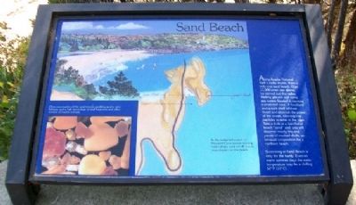
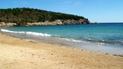
Along Acadia National Park's rocky shores, there is only one sand beach. Over 15,000 years ago glacial ice carved out this valley. Melting glaciers and rising sea waters flooded it, creating a protected cove. A headland and a rock shelf offshore divert and diminish the power of the ocean, allowing fine particles to settle in the cove. Take a look at a handful of beach "sand" and you will discover mostly bits and pieces of crushed shells, an unusual composition for a northern beach.
Swimming at Sand Beach is only for the hardy. Even on warm summer days the water temperature may be a chilling 50°F (10°C).
[Background illustration caption reads]
In the protected waters of Newport Cove slower-moving water drops sand which waves may deposit on the beach.
[Photo caption reads]
Close examination of the sand reveals sparkling quartz, pink feldspar, and a high percentage of shell fragments and other remains of marine animals.
Erected by National Park Service.
Topics. This historical marker is listed in this topic list: Natural Features.
Location. 44° 19.762′ N, 68° 11.023′ W. Marker is near Bar Harbor, Maine, in Hancock County. Marker is near the stairway leading onto Sand Beach, off Park Loop Road in Acadia National Park. Touch for map. Marker is in this post office area: Bar Harbor ME 04609, United States of America. Touch for directions.
Other nearby markers. At least 8 other markers are within walking distance of this marker. Unusual Pocket Beach (here, next to this marker); Secrets of the Sand (here, next to this marker); Satterlee Field (here, next to this marker); What Do Park Rangers Do? (approx. 0.6 miles away); Icy Depths (approx. 0.6 miles away); Sounds of the Sea (approx. 0.6 miles away); Thunder Hole Ranger Station (approx. 0.6 miles away); Thunder Hole (approx. 0.7 miles away). Touch for a list and map of all markers in Bar Harbor.
Also see . . . Acadia National Park. (Submitted on April 14, 2012, by William Fischer, Jr. of Scranton, Pennsylvania.)
Credits. This page was last revised on June 16, 2016. It was originally submitted on April 14, 2012, by William Fischer, Jr. of Scranton, Pennsylvania. This page has been viewed 569 times since then and 3 times this year. Photos: 1, 2, 3. submitted on April 14, 2012, by William Fischer, Jr. of Scranton, Pennsylvania.


