Berkeley in Alameda County, California — The American West (Pacific Coastal)
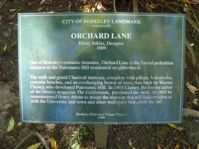
Orchard Lane
Henry Atkins, Designer
— 1909 —
designated in 1991
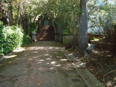
The walk and grand Classical staircase, complete with pillars, balustrades, concrete benches, and an overhanging bower of trees, was built by Warren Cheney, who developed Panoramic Hill. In 1904 Cheney, the former editor of the literary magazine The Californian, purchased the land. In 1909 he commissioned Henry Atkins to design the staircase that still links residences with the University and town and other walkways that climb the hill
Erected 1998 by Berkeley Historical Plaque Project.
Topics. This historical marker is listed in this topic list: Notable Places. A significant historical year for this entry is 1991.
Location. 37° 52.137′ N, 122° 14.967′ W. Marker is in Berkeley, California, in Alameda County. Marker can be reached from Panoramic Way. Orchard Lane is a stairway/walking path that begins between 1 and 5-11 Panoramic Way. This marker is found on the right side while ascending the stairway. Touch for map. Marker is at or near this postal address: 1 Panoramic Way, Berkeley CA 94704, United States of America. Touch for directions.
Other nearby markers. At least 8 other markers are within walking distance of this marker. Panoramic Hill (within shouting distance of this marker); Piedmont Way (approx. 0.2 miles away); John Fitzgerald Kennedy Charter Day Speech (approx. ¼ mile away); Berkeley Piano Club (approx. ¼ mile away); Clark Kerr Campus (approx. 0.3 miles away); Ernest V. Cowell Memorial Hospital (approx. 0.3 miles away); First Church of Christ, Scientist (approx. 0.4 miles away); American Baptist Seminary of the West - Hobart Hall (approx. 0.4 miles away). Touch for a list and map of all markers in Berkeley.
Credits. This page was last revised on June 16, 2016. It was originally submitted on April 21, 2012, by Barry Swackhamer of Brentwood, California. This page has been viewed 972 times since then and 32 times this year. Photos: 1, 2. submitted on April 21, 2012, by Barry Swackhamer of Brentwood, California. • Syd Whittle was the editor who published this page.

