Near Sharpsburg in Washington County, Maryland — The American Northeast (Mid-Atlantic)
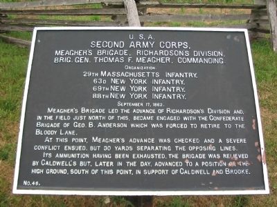
Second Army Corps
Meagher's Brigade, Richardson's Division
Second Army Corps
Meagher's Brigade, Richardson's Division,
Brig. Gen. Thomas F. Meagher, Commanding
Organization
29th Massachusetts Infantry
63rd New York Infantry
69th New York Infantry
88th New York Infantry
September 17, 1862
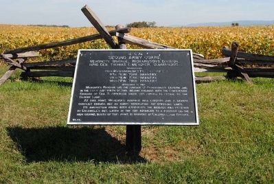
Meagher's Brigade led the advance of Richardson's Division and, in the field just north of this, became engaged with the Confederate Brigade of Geo. B. Anderson which was forced to retire to the Bloody Lane.
At this point, Meagher's advance was checked and a severe conflict ensued, but 30 yards separating the opposing lines.
Its ammunition having been exhausted, the Brigade was relieved by Caldwell's but, later in the day, advanced to a position on the high ground, south of this point, in support of Caldwell and Brooke.
Erected by Antietam Battlefield Board. (Marker Number 46.)
Topics and series. This historical marker is listed in this topic list: War, US Civil. In addition, it is included in the Antietam Campaign War Department Markers series list. A significant historical month for this entry is September 1732.
Location. 39° 28.208′ N, 77° 44.24′ W. Marker is near Sharpsburg, Maryland, in Washington County. Marker is on Richardson Avenue, on the left when traveling east. Located at a tablet cluster near the Sunken Road, stop eight on the driving tour of Antietam. Touch for map. Marker is in this post office area: Sharpsburg MD 21782, United States of America. Touch for directions.
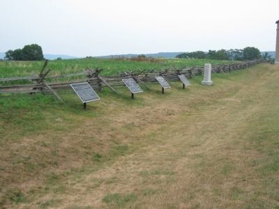
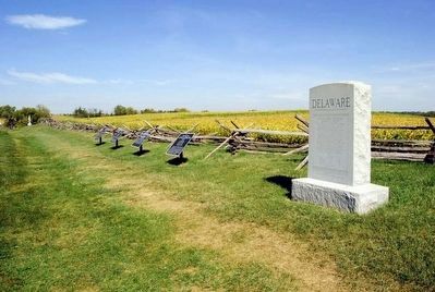
Other nearby markers. At least 10 other markers are within walking distance of this marker. A different marker also named Second Army Corps (here, next to this marker); Richardson's Division, Second Army Corps (a few steps from this marker); a different marker also named Second Army Corps (a few steps from this marker); 2nd Delaware (a few steps from this marker); Anderson’s Division, Longstreet’s Command (a few steps from this marker); Brigadier General George B. Anderson (about 300 feet away, measured in a direct line); Jackson's Command (about 300 feet away); Army of the Potomac (about 300 feet away); September 16, 1862 (about 300 feet away); September 17, 1862 (about 300 feet away). Touch for a list and map of all markers in Sharpsburg.
Regarding Second Army Corps. This marker is included on the Sunken Road or Bloody Lane Virtual Tour by Markers see the Virtual tour link below to see the markers in sequence.
Also see . . .
1. Antietam Battlefield. National Park Service site. (Submitted on February 18, 2008, by Craig Swain of Leesburg, Virginia.)
2. Irish Brigade - 2nd Brigade, 1st Division, II Corps. Among the members of the brigade was Private Samuel Wright of the 29th Massachusetts, who received the Medal of Honor for his actions during the battle. He braved Confederate fire to tear down a fence blocking the Regiment's advance. (Submitted on February 18, 2008, by Craig Swain of Leesburg, Virginia.)
3. Thomas Francis Meagher. With the beginning of war, Meagher volunteered to fight for the Union. He recruited a full company of infantrymen to be attached to the U.S. 69th Infantry Regiment New York State Volunteers on April 29, 1861. (Submitted on September 27, 2015, by Brian Scott of Anderson, South Carolina.)
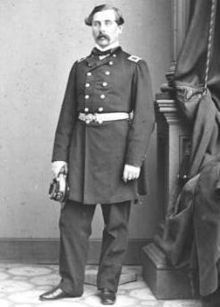
5. Brig. General Thomas Francis Meagher (1823-1867)
The Irish Brigade suffered huge losses at the Battle of Antietam that fall. Meagher's brigade led an attack at Antietam on September 17 against the Sunken Road (later referred to as "Bloody Lane") and lost 540 men to heavy volleys before being ordered to withdraw. During the battle, Meagher was injured when he fell off his horse. Some reports said Meagher had been drunk. But, Maj. Gen. George B. McClellan's official report noted that Meagher's horse had been shot. Meagher had faced false reports of drunkenness at the First Battle of Bull Run. The high number of casualties at Antietam, and the rumors of being drunk on the battlefield, increased criticism of Meagher's command ability.
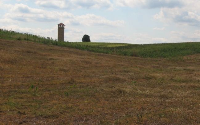
Photographed By Craig Swain, September 17, 2007
6. Meager's (Irish) Brigade Advance
To reach the Sunken Road, the brigade had to march up this slope. The observation tower is a good placemark, roughly where the left flank of the brigade advanced. The regiments, arranged from left to right were the 88th New York, 63rd New York, 29th Massachusetts, and 69th New York.
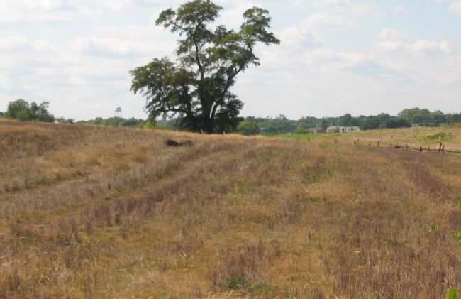
Photographed By Craig Swain, September 17, 2007
7. The Sunken Road seen from the Brigade's Line
When the brigade reached the top of the slope, the range to the Confederate position was only a few hundred yards at best. The snake rail fence next to the road can be seen beside the tree in the center. The tree stands close to the 132nd Pennsylvania Monument on the road. Most of the brigade was armed with smoothbore Model 1842 Springfield muskets, loaded with "buck and ball" rounds. At other battlefields, such armament was at disadvantage to rifled muskets. Here, with the close ranges and multiple projectiles from each load, the smoothbores had some advantages.
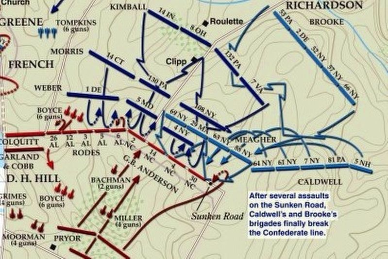
via American Battlefield Trust, unknown
8. Sunken Road or Bloody Lane Virtual Tour by Markers.
A collection of markers interpreting the action of during the Battle of Antietam around the Sunken Road.
(Submitted on February 23, 2008, by Craig Swain of Leesburg, Virginia.)
Click for more information.
(Submitted on February 23, 2008, by Craig Swain of Leesburg, Virginia.)
Click for more information.
Credits. This page was last revised on April 3, 2022. It was originally submitted on February 18, 2008, by Craig Swain of Leesburg, Virginia. This page has been viewed 1,113 times since then and 22 times this year. Photos: 1. submitted on February 18, 2008, by Craig Swain of Leesburg, Virginia. 2. submitted on September 27, 2015, by Brian Scott of Anderson, South Carolina. 3. submitted on February 18, 2008, by Craig Swain of Leesburg, Virginia. 4, 5. submitted on September 27, 2015, by Brian Scott of Anderson, South Carolina. 6, 7. submitted on February 18, 2008, by Craig Swain of Leesburg, Virginia. 8. submitted on April 3, 2022, by Larry Gertner of New York, New York.
