Near Sharpsburg in Washington County, Maryland — The American Northeast (Mid-Atlantic)
Jackson's Command
Hays' Brigade, Ewell's Division
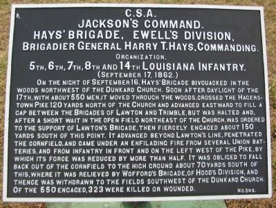
Jackson's Command.
Hays' Brigade, Ewell's Division,
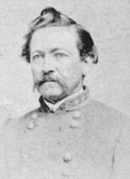
Brigadier General Harry T. Hays, Commanding.
Organization.
5th, 6th, 7th, 8th and 14th Louisiana Infantry.
(September 17, 1862.)
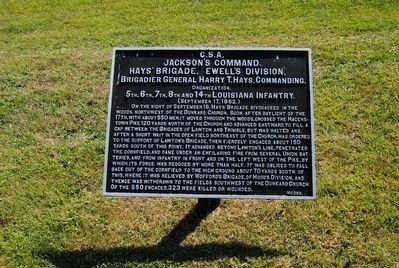
On the night of September 16, Hays' Brigade bivouacked in the woods northwest of the Dunkard Church. Soon after daylight of the 17th, with about 550 men, it moved through the woods, crossed the Hagerstown Pike 120 yards north of the Church and advanced eastward to fill a gap between the Brigades of Lawton and Trimble, but was halted and, after a short wait in the open field northeast of the Church, was ordered to the support of Lawton's Brigade, then fiercely engaged about 150 yards south of this point. It advanced beyond Lawton's line, penetrated the cornfield, and came under an enfilading fire from several Union batteries, and from infantry in front and on the left west of the Pike, by which its force was reduced by more than half. It was obliged to fall back out of the cornfield to the high ground about 70 yards south of this, where it was relieved by Wofford's Brigade, of Hood's Division, and thence was withdrawn to the fields southwest of the Dunkard Church. Of the 550 engaged, 323 were killed or wounded.
Erected by Antietam Battlefield Board. (Marker Number 383.)
Topics and series. This historical marker is listed in this topic list: War, US Civil. In addition, it is included in the Antietam Campaign War Department Markers series list. A significant historical date for this entry is September 16, 1862.
Location. 39° 28.854′ N, 77° 44.786′ W. Marker is near Sharpsburg, Maryland, in Washington County. Marker is on Cornfield Avenue, on the right when traveling east. Located between stops three and four of the driving tour of Antietam Battlefield. Touch for map. Marker is in this post office area: Sharpsburg MD 21782, United States of America. Touch for directions.
Other nearby markers. At least 10 other markers are within walking distance of this marker. Longstreet's Command (a few steps from this marker); a different marker also named Longstreet's Command (within shouting distance of this marker); 84th New York (14th Brooklyn) Volunteer Infantry (within shouting distance of this marker); Texas (within shouting distance of this marker); Georgia Confederate Soldiers (within shouting distance of this marker); First Army Corps (within shouting distance of this marker); Hood's Division, Longstreet's Command (within shouting distance of this marker); a different marker also named Hood's Division, Longstreet's Command (within shouting distance of this marker); a different marker also named Jackson's Command (within shouting distance of this marker); a different marker also named First Army Corps (within shouting distance of this marker). Touch for a list and map of all markers in Sharpsburg.
Related markers. Click here for a list of markers that are related to this marker. Follow Hays' Brigade by Tablets.
Also see . . .
1. Antietam Batlefield. National Park Service site. (Submitted on February 23, 2008, by Craig Swain of Leesburg, Virginia.)
2. Tiger Brigade. Five regiments of infantry and one battery of artillery from Louisiana served under General Henry T. Hays. (Submitted on February 23, 2008, by Craig Swain of Leesburg, Virginia.)
3. Harry T. Hays. Harry Thompson Hays (April 14, 1820 – August 21, 1876) was an American Army officer serving in the Mexican-American War and a general who served in the Confederate Army during the American Civil War. (Submitted on October 21, 2015, by Brian Scott of Anderson, South Carolina.)
Additional commentary.
1. Louisiana Tigers
Among the famous units in the Confederate Army, the brigade gained
Photographed By Craig Swain, February 9, 2008
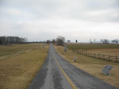
3. Cornfield Avenue Looking East
Cornfield Avenue boasts numerous monuments and markers. Although the road did not exist at the time of the battle, both sides contested this ground during the morning phase of the battle. The spire on the right side of the road is the Georgia Monument. The War Department tablets between the monument and the camera are, in order of furthest to nearest: Wofford's Brigade (16 September), Hays' Brigade, and Wofford's Brigade (17 September).
— Submitted February 23, 2008, by Craig Swain of Leesburg, Virginia.
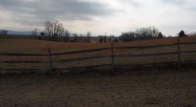
Photographed By Craig Swain, February 9, 2008
5. Hays Brigade Advance and Retreat
Looking south from the monument, Hays brigade advanced up from the Dunker Church through here, and later retired past this point. The modern park visitors center is seen in the far distance near the New York State monument spire. The open field mentioned on the marker text was beyond the treeline in center frame. Notice the high ground to the right, part of the rock ledge bordering the plateau running through this part of the battlefield, north to south. The ledge served to divide the fighting in the cornfield, and offer the Federals a position to enfilade Hays' men.
Credits. This page was last revised on September 29, 2017. It was originally submitted on February 23, 2008, by Craig Swain of Leesburg, Virginia. This page has been viewed 910 times since then and 21 times this year. Photos: 1. submitted on February 23, 2008, by Craig Swain of Leesburg, Virginia. 2. submitted on October 21, 2015, by Brian Scott of Anderson, South Carolina. 3. submitted on February 23, 2008, by Craig Swain of Leesburg, Virginia. 4. submitted on October 21, 2015, by Brian Scott of Anderson, South Carolina. 5. submitted on February 23, 2008, by Craig Swain of Leesburg, Virginia.
