Skinnersville in Washington County, North Carolina — The American South (South Atlantic)
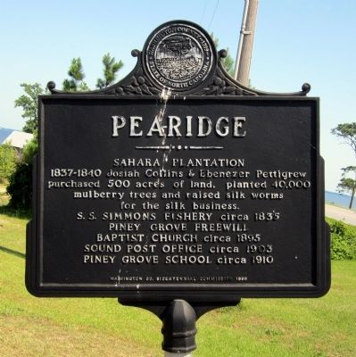
Pearidge
Saharah Plantation
S.S. Simmons Fishery circa 1835
Piney Grove Freewill Baptist Church circa 1895
Sound Post Office circa 1903
Piney Grove School circa 1910
Erected 1999 by Washington Co. Bicentennial Commission.
Topics. This historical marker is listed in these topic lists: Agriculture • Settlements & Settlers. A significant historical year for this entry is 1835.
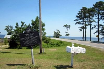
Location. 35° 57.515′ N, 76° 29.367′ W. Marker is in Skinnersville, North Carolina, in Washington County. Marker is at the intersection of State Highway 32 and Breezy Banks Road, on the left when traveling north on State Highway 32. Touch for map. Marker is in this post office area: Roper NC 27970, United States of America. Touch for directions.
Other nearby markers. At least 8 other markers are within 8 miles of this marker, measured as the crow flies. Rehoboth Church (approx. 2.3 miles away); Edward Vail (approx. 4.8 miles away); Mackeys Ferry (approx. 6.1 miles away); The Davenport Home (approx. 6˝ miles away); Davenport Homestead (approx. 6˝ miles away); Lake Company (approx. 8.1 miles away); Concord Primitive Baptist Church (approx. 8.1 miles away); James Johnston Pettigrew (approx. 8.1 miles away).
Credits. This page was last revised on June 16, 2016. It was originally submitted on July 2, 2012, by Bernard Fisher of Richmond, Virginia. This page has been viewed 409 times since then and 24 times this year. Photos: 1, 2. submitted on July 2, 2012, by Bernard Fisher of Richmond, Virginia.

