Near Jamestown in Tuolumne County, California — The American West (Pacific Coastal)
Woods Crossing
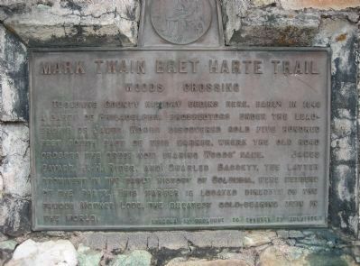
— Mark Twain Bret Harte Trail —
Inscription.
Tuolumne County history begins here. Early in 1848 a party of Philadelphia prospectors under the leadership of James Woods discovered gold 500 feet south east of this marker, where the old road crosses the creek now bearing Woods’ name. James Savage, J.H. Rider, and Searles Bassett, the lawyer prominent in the early history of Columbia, were members of the party. This marker is located directly on the famous Mother Lode, the greatest gold-bearing vein in the world.
Erected by Tuolumne County Chamber of Commerce.
Topics and series. This historical marker is listed in these topic lists: Natural Resources • Notable Events. In addition, it is included in the Mark Twain Bret Harte Trail series list. A significant historical year for this entry is 1848.
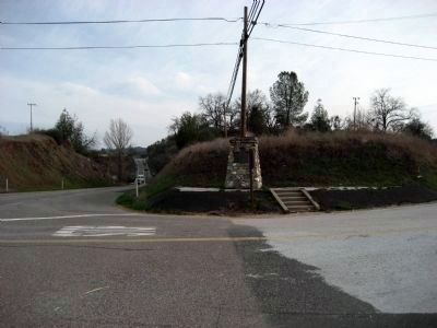
Location. 37° 56.405′ N, 120° 26.044′ W. Marker is near Jamestown, California, in Tuolumne County. Marker is at the intersection of Sonora Pass Highway (State Highway 49/108) and Bell Mooney Rd, on the right when traveling east on Sonora Pass Highway. The marker is 4.5 miles from downtown Sonora (intersection of North Washington St and Stockton Rd). Touch for map. Marker is in this post office area: Jamestown CA 95327, United States of America. Touch for directions.
Other nearby markers. At least 8 other markers are within 2 miles of this marker, measured as the crow flies. St. James Church (approx. 0.9 miles away); Jamestown (approx. one mile away); The Emporium – 1897 (approx. 1.1 miles away); National Hotel (approx. 1.1 miles away); Ramirez – Preston Building (approx. 1.1 miles away); a different marker also named Jamestown (approx. 1.1 miles away); Rocca Park (approx. 1.1 miles away); Jamestown United Methodist Church (approx. 1.1 miles away). Touch for a list and map of all markers in Jamestown.
More about this marker. A good turnout does not exist. The highway is very busy so take care when parking.
Regarding Woods Crossing. The white quartz vein know as the Mother Lode is six feet thick and can be seen in the highway cut approximately 300 feet east.
Additional keywords. California Gold Rush

Photographed By Richard Wisehart, February 13, 2008
2. Mark Twain Bret Harte Trail - Woods Crossing Marker
View is easterly towards Jamestown and Sonora. Highway 49/108 is on left; Bell Mooney Rd is in foreground. Mother Lode vein of striking white quartzite is approximately 300 feet east of the marker in the cut bank on the north (left) side of the highway.
Credits. This page was last revised on June 16, 2016. It was originally submitted on February 24, 2008, by Richard Wisehart of Sonora, California. This page has been viewed 1,714 times since then and 46 times this year. Last updated on February 27, 2008, by Richard Wisehart of Sonora, California. Photos: 1, 2. submitted on February 24, 2008, by Richard Wisehart of Sonora, California. • Craig Swain was the editor who published this page.
