Hurricane in Washington County, Utah — The American Mountains (Southwest)
Historic Kolob Mountain
by Owen Sanders
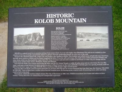
and robs you of zest to exist
come with me to Kolob
and walk through the mild morning mist
Huddle at dawn on a hillside
and scan the green valley below;
Listen to snapping and crackle of twigs
and thumping of hoofs on the go!
When shots re-echo at daybreak
your pulse starts pounding anew
as you search to locate your quarry
and forget the breathtaking view
Come back with me to Kolob
it’s fun to be with you up there
Sluff off the work-a-day worry
in the sparkling, clear mountain air!
Kolob is a majestic jewel in an awesome setting of rare scenic charm. It is one mile higher than Hurricane City and can be reached in a few minutes by driving constantly upward from plateau to plateau, through spellbinding beauty at every turn in the road.
Pioneers who colonized Toquerville, Virgin City and Grafton, also ranched on Kolob. They hobbled and milked scores of half wild cows fresh from the lush green pastures of Kolob and the desert rangeland far below. From the milk and cream they made many crocks and barrels of butter and zesty cheese which was then hauled by wagon down the steep mountain road and sold or traded to merchants in Cedar City, St. George, and the mining towns of Silver Reef, Frisco, New House, Pioche, and Delamar.
From Kolob Peak, Zion Canyon can be seen far below and the St. George Temple is visible fifty miles away and one mile below. For over 50 years a pole gate swung between two giant ponderosa pines in Black Canyon on the road to Kolob. Until this gate was opened, livestock could not drift from the lower range onto upper Kolob. Sheer sandstone cliffs formed a high natural barrier.
From the West, and South several massive pinnacles jut out from Kolob and rise several thousand feet from their base, like fabulous "Islands in the Sky." Some of these have a surface area of several hundred acres. By fencing across a narrow neck of connecting land, cattle and sheep could be held on this land.
Descendants of Kolob Ranchers helped colonize the City of Hurricane in 1906. Now, their descendants have homes and cabins on these ranches. Visiting Kolb is a exhilarating and unforgettable experience.
Erected by James Allen Ballard and wife Joan Webb Ballard.
Topics. This historical marker is listed in these topic lists: Natural Features • Settlements & Settlers. A significant historical year for this entry is 1906.
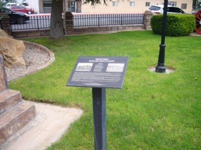
Location. 37° 10.576′ N, 113° 17.304′ W. Marker is in Hurricane, Utah, in Washington County. Marker is in Hurricane Valley Pioneer Heritage Park. Touch for map. Marker is at or near this postal address: 35 West State Street, Hurricane UT 84737, United States of America. Touch for directions.
Other nearby markers. At least 8 other markers are within walking distance of this marker. Pioneer Gratitude (a few steps from this marker); Many Came by Handcart (a few steps from this marker); The Town Named After a Buggy Incident (a few steps from this marker); Survival in Utah’s Dixie (a few steps from this marker); Smith Mesa (a few steps from this marker); Early Day Wood Beam Walking Hand Plow (a few steps from this marker); Pioneer Trails (within shouting distance of this marker); Hurricane Canal (within shouting distance of this marker). Touch for a list and map of all markers in Hurricane.
Credits. This page was last revised on June 16, 2016. It was originally submitted on September 10, 2012, by Bill Kirchner of Tucson, Arizona. This page has been viewed 523 times since then and 18 times this year. Photos: 1, 2. submitted on September 10, 2012, by Bill Kirchner of Tucson, Arizona. • Syd Whittle was the editor who published this page.
Editor’s want-list for this marker. Photos of Kolob Mountain. • Can you help?

