Appomattox in Appomattox County, Virginia — The American South (Mid-Atlantic)
Final Combat
Private John L. Smith, 118th Pennsylvania
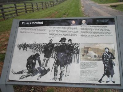
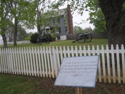
Late on the morning of April 9, 1865, the Army of Northern Virginia engaged in its final combat. Before the flags of truce passed along the entire line – and as the Confederates withdrew through the village – the two sides exchanged scattered last shots. Some of the last cannons discharged were fired from the yard of the Peers House, to your left.
The cannon in the Peers yard caused some of the last casualties of the war in Virginia. The Confederate guns fired at Union infantry advancing toward you, across the distant ridge. The identity of the last man killed in the fighting here is not known, but all of the men who died during the final battle at Appomattox Court House suffered a cruel and ironic fate.
Erected by Appomattox Court House National Historic Park, National Park Service.
Topics. This historical marker is listed in this topic list: War, US Civil. A significant historical date for this entry is April 9, 1865.
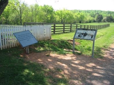
Location. 37° 22.665′ N, 78° 47.596′ W. Marker is in Appomattox, Virginia, in Appomattox County. Marker is on George Peers Drive (State Highway 24), on the right when traveling west. Marker is in eastern part of the village of Appomattox Court House on Prince Edward Court House Road (a walking path), near the Richmond-Lynchburg Stage Road. It is located in front of the Peers House. Touch for map. Marker is at or near this postal address: 330 George Peers Dr, Appomattox VA 24522, United States of America. Touch for directions.
Other nearby markers. At least 8 other markers are within walking distance of this marker. Last Artillery Shots (here, next to this marker); The Surrender Ceremony (within shouting distance of this marker); Lee and Grant Meet (about 400 feet away, measured in a direct line); “Salute of Arms” (about 500 feet away); Grant and Lee Meeting (about 500 feet away); County Jail (about 600 feet away); Clover Hill Tavern (about 800 feet away); The Isbell House (approx. 0.2 miles away). Touch for a list and map of all markers in Appomattox.
More about this marker. The background of the marker features a Union officer kneeling over a dead soldier as other officers look on. It has a caption of The death of Lt. Hiram Clark of the 185th New York during the last minutes of fighting at Appomattox Court House (left). Clark was killed while his regiment advanced toward you from the distant ridge beyond the Wright House.
In the lower right of the marker is a picture of a soldier with the caption Private William Montgomery
(right) of the 155th Pennsylvania was just 19 years old when struck by a cannon shell the morning of April 9.
There is also a picture of Confederate artillery firing with the caption A gun of the Richmond Howitzers offers final defiance from the yard of the Peers House (above). The Howitzers had been in the war’s first major battle at Manassas in 1861. On April 9, 1865, they fired some of the last shots here at Appomattox Court House.
Also see . . . Appomattox Court House National Historical Park. (Submitted on March 4, 2008, by Bill Coughlin of Woodland Park, New Jersey.)
Credits. This page was last revised on March 21, 2020. It was originally submitted on March 4, 2008, by Bill Coughlin of Woodland Park, New Jersey. This page has been viewed 1,748 times since then and 16 times this year. Photos: 1, 2. submitted on March 4, 2008, by Bill Coughlin of Woodland Park, New Jersey. 3. submitted on April 25, 2010, by Craig Swain of Leesburg, Virginia. • Craig Swain was the editor who published this page.


