Hays in Ellis County, Kansas — The American Midwest (Upper Plains)
Parade Ground
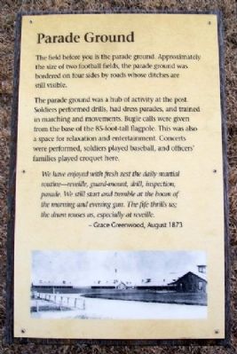
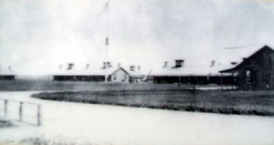
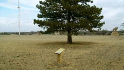
The field before you is the parade ground. Approximately the size of two football fields, the parade ground was bordered on four sides by roads whose ditches are still visible.
The parade ground was a hub of activity at the post. Soldiers performed drills, had dress parades, and trained in marching and movements. Bugle calls were given from the base of the 85-foot-tall flagpole. This was also a space for relaxation and entertainment. Concerts were performed, soldiers played baseball, and officers’ families played croquet here.
We have enjoyed with fresh zest the daily martial routine – reveille, guard-mount, drill, inspection, parade. We still start and tremble at the boom of the morning and evening gun. The fife thrills us; the drum rouses us, especially at reveille.
- Grace Greenwood, August 1873
Erected by Kansas Historical Society.
Topics. This historical marker is listed in these topic lists: Forts and Castles • Wars, US Indian. A significant historical year for this entry is 1873.
Location. 38° 51.766′ N, 99° 20.605′ W. Marker is in Hays, Kansas, in Ellis County. Marker is on the grounds of Fort Hays State Historic Site, off US Hwy 163 Alternate. Touch for map. Marker is at or near this postal address: 1472 US Highway 163 Alternate, Hays KS 67601, United States of America. Touch for directions.
Other nearby markers. At least 8 other markers are within walking distance of this marker. Officers' Row (here, next to this marker); Enlisted Barracks (a few steps from this marker); Fort Hays - Fort Dodge Road Trailhead (a few steps from this marker); Elizabeth Bacon Custer (within shouting distance of this marker); Fort Hays (within shouting distance of this marker); Garden (within shouting distance of this marker); Outhouses (within shouting distance of this marker); Commanding Officer's House (within shouting distance of this marker). Touch for a list and map of all markers in Hays.
Also see . . .
1. Fort Hays State Historic Site. (Submitted on September 23, 2012, by William Fischer, Jr. of Scranton, Pennsylvania.)
2. Fort Hays State Historic Site. (Submitted on September 23, 2012, by William Fischer, Jr. of Scranton, Pennsylvania.)
3. Fort Hays at Kansapedia. (Submitted on September 25, 2012, by William Fischer, Jr. of Scranton, Pennsylvania.)
Credits. This page was last revised on June 16, 2016. It was originally submitted on September 23, 2012, by William Fischer, Jr. of Scranton, Pennsylvania. This page has been viewed 452 times since then and 15 times this year. Photos: 1, 2, 3. submitted on September 23, 2012, by William Fischer, Jr. of Scranton, Pennsylvania.


