Hays in Ellis County, Kansas — The American Midwest (Upper Plains)
Blockhouse
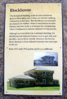
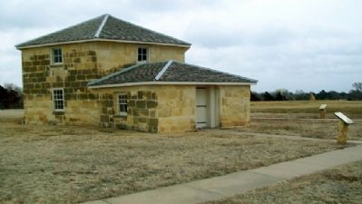
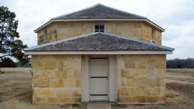
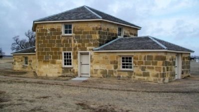
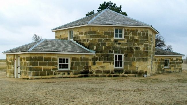
This hexagonal building, made of native limestone quarried three miles west of here, was the first building constructed at Fort Hays. The blockhouse was intended as a barracks for soldiers. When it was finished wooden barracks had been built, so it became the commanding officer's headquarters and post adjutant's living quarters.
Although not intended to be a defensive building, the blockhouse had defensive features such as gun slots and possibly a second floor catwalk. However, the fort was never attacked so these defensive features were never put to the test.
From 1931 until 1955 golfers used it as a clubhouse.
Erected by Kansas Historical Society.
Topics. This historical marker is listed in these topic lists: Forts and Castles • Sports • Wars, US Indian. A significant historical year for this entry is 1931.
Location. 38° 51.695′ N, 99° 20.548′ W. Marker is in Hays, Kansas, in Ellis County. Marker is on the grounds of Fort Hays State Historic Site, off US Hwy 163 Alternate. Touch for map. Marker is at or near this postal address: 1472 US Highway 163 Alternate, Hays KS 67601, United States of America. Touch for directions.
Other nearby markers. At least 8 other markers are within walking distance of this marker. Post Trader's Store (a few steps from this marker); Laundress' Quarters (a few steps from this marker); Band Barracks (a few steps from this marker); Icehouse (within shouting distance of this marker); Chapel (within shouting distance of this marker); Post Surgeon's Quarters (within shouting distance of this marker); Bake House (within shouting distance of this marker); Fort Hays Soldiers (within shouting distance of this marker). Touch for a list and map of all markers in Hays.
Also see . . .
1. Fort Hays State Historic Site. (Submitted on September 25, 2012, by William Fischer, Jr. of Scranton, Pennsylvania.)
2. Fort Hays State Historic Site. (Submitted on September 25, 2012, by William Fischer, Jr. of Scranton, Pennsylvania.)
3. Fort Hays at Kansapedia. (Submitted on September 25, 2012, by William Fischer, Jr. of Scranton, Pennsylvania.)
Credits. This page was last revised on September 1, 2020. It was originally submitted on September 25, 2012, by William Fischer, Jr. of Scranton, Pennsylvania. This page has been viewed 393 times since then and 15 times this year. Photos: 1, 2, 3, 4, 5. submitted on September 25, 2012, by William Fischer, Jr. of Scranton, Pennsylvania.
