Downers Grove in DuPage County, Illinois — The American Midwest (Great Lakes)
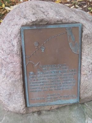
The Indian Boundary Line
Erected 1976 by The Indian Boundary Y's Men's Club.
Topics. This historical marker is listed in this topic list: Native Americans. A significant historical date for this entry is August 24, 1816.
Location. 41° 47.572′ N, 88° 0.329′ W. Marker is in Downers Grove, Illinois, in DuPage County. Marker is at the intersection of Maple Avenue and Belden Avenue, on the right when traveling east on Maple Avenue. Touch for map. Marker is at or near this postal address: 831 Maple Avenue, Downers Grove IL 60515, United States of America. Touch for directions.
Other nearby markers. At least 8 other markers are within 5 miles of this marker, measured as the crow flies. Masonic Temple (about 700 feet away, measured in a direct line); Farmer's and Merchant's Bank Building (approx. ¼ mile away); Main Street Cemetery (approx. ¼ mile away); a different marker also named Main Street Cemetery (approx. 0.3 miles away); Ben Fuller House (approx. 4½ miles away); Get Your "Chicks" on Rte 66 (approx. 4.7 miles away); Dell Rhea's Chicken Basket (approx. 4.7 miles away); Bruno F. Shustek (approx. 5 miles away). Touch for a list and map of all markers in Downers Grove.
Credits. This page was last revised on June 16, 2016. It was originally submitted on October 5, 2012. This page has been viewed 1,275 times since then and 61 times this year. Photos: 1, 2. submitted on October 5, 2012. • Bill Pfingsten was the editor who published this page.

