Near Baldwyn in Lee County, Mississippi — The American South (East South Central)
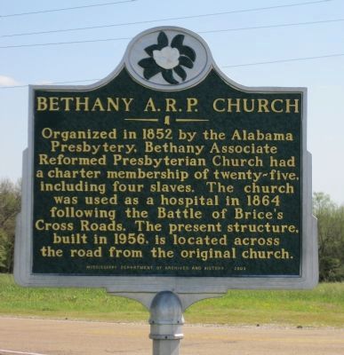
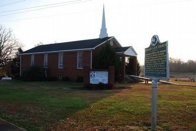
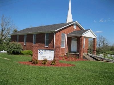
Bethany A.R.P. Church
Erected 2002 by Mississippi Department of Archives and History.
Topics and series. This historical marker is listed in these topic lists: Churches & Religion • War, US Civil. In addition, it is included in the Mississippi State Historical Marker Program series list. A significant historical year for this entry is 1852.
Location. 34° 30.332′ N, 88° 43.739′ W. Marker is near Baldwyn, Mississippi, in Lee County. Marker is at the intersection of Guntown Road (County Route 833) and Bethany Road (Mississippi Highway 330), on the right when traveling west on Guntown Road. Bethany Church is across Bethany Road from the NPS Battle of Brice's Road site. Bethany Road continues southeast renamed to Pontotoc Road (County Rd 2902). Guntown Road continues northeast renamed to Ripley Road (State Rd. 370). Touch for map. Marker is in this post office area: Baldwyn MS 38824, United States of America. Touch for directions.
Other nearby markers. At least 8 other markers are within walking distance of this marker. Brice Home (a few steps from this marker); Morton's Battery (within shouting distance of this marker); Battle of Brice's Cross Roads (within shouting distance of this marker); a different marker also named Battle of Brices Cross Roads (within shouting distance of this marker); General Sturgis' Supreme Effort (within shouting distance of this marker); Tyler's Flanking Maneuver (about 300 feet away, measured in a direct line); Federal's Second Battle Line (about 600 feet away); Brice's Cross Roads (about 800 feet away). Touch for a list and map of all markers in Baldwyn.
More about this marker. Bethany Church Cemetery is located beside the church and contains the graves of about 60 Confederates who died at the Battle of Brices Crossroads.
Related marker. Click here for another marker that is related to this marker. To better understand the relationship, study each marker in the order shown.
Additional keywords. Forrest, Sturgis
Credits. This page was last revised on June 16, 2016. It was originally submitted on October 31, 2012, by David Graff of Halifax, Nova Scotia. This page has been viewed 791 times since then and 39 times this year. Photos: 1. submitted on October 31, 2012, by David Graff of Halifax, Nova Scotia. 2. submitted on September 25, 2015, by Brandon Fletcher of Chattanooga, Tennessee. 3. submitted on October 31, 2012, by David Graff of Halifax, Nova Scotia. • Craig Swain was the editor who published this page.


