Lawton in Comanche County, Oklahoma — The American South (West South Central)
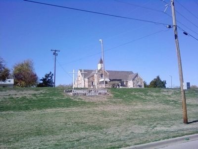
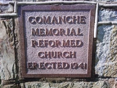
Comanche Reformed Church
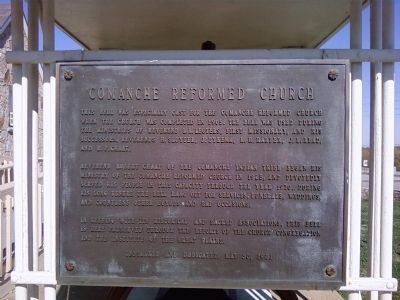
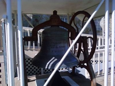
This bell was especially cast for the Comanche Reformed Church when the church was completed in 1905. The bell was used during the ministries of Reverend L.L. Legters, first missionary, and his successors, Reverends H. Sluyter, J. Dykema, R.H. Harper, J.L. Read, and R.P. Chaat.
Reverend Robert Chaat of the Comanche Indian Tribe began his ministry of the Comanche Reformed Church in 1925, and devotedly served his people in this capacity throughout the year 1970. During his long tenure the bell rang out for services, funerals, weddings, and countless other joyous and sad occasions.
In keeping with its historical and sacred associations, this bell is here preserved through the efforts of the Church congregation and the Institute of the Great Plains.
Installed and dedicated, May 30, 1971
Erected 1971 by Congregation of the Comanche Reformed Church and the Institute of the Great Plains.
Topics. This historical marker is listed in these topic lists: Churches & Religion • Native Americans. A significant historical date for this entry is May 30, 1870.
Location. 34° 37.983′ N, 98° 23.283′ W. Marker is in Lawton, Oklahoma, in Comanche County. Marker can be reached from Indian Trail Road north of NW Mission Boulevard, on the left when traveling north. Touch for map. Marker is in this post office area: Lawton OK 73507, United States of America. Touch for directions.
Other nearby markers. At least 8 other markers are within 3 miles of this marker, measured as the crow flies. The Queen of the Frisco Railroad (approx. 1.2 miles away); Chief Ten Bears (approx. 1.2 miles away); Col Jack L. Treadwell (approx. 1.4 miles away); Satank Killed (approx. 1˝ miles away); Fort Sill (approx. 2 miles away); M51 Skysweeper 75mm Anti Aircraft Gun (approx. 2.2 miles away); Soviet M1939 52-K 85mm Anti Aircraft Gun (approx. 2.2 miles away); Lockheed X-7A1 Target Drone (approx. 2.2 miles away). Touch for a list and map of all markers in Lawton.
More about this marker. Church can be seen from US Interstate 44 (H.E. Bailey Turnpike) and can be accessed from either exit 39 or 40.
Also see . . .
1. Reformed Church in America. information about the Comanche Reformed Church can be found about halfway down the page. (Submitted on November 5, 2012, by Lee Hattabaugh of Capshaw, Alabama.)
2. Wikipedia - Meneely Bell Foundry. (Submitted on November 5, 2012, by Lee Hattabaugh of Capshaw, Alabama.)
Credits. This page was last revised on June 16, 2016. It was originally submitted on November 5, 2012, by Lee Hattabaugh of Capshaw, Alabama. This page has been viewed 1,269 times since then and 51 times this year. Photos: 1, 2, 3, 4, 5, 6, 7. submitted on November 5, 2012, by Lee Hattabaugh of Capshaw, Alabama. • Bernard Fisher was the editor who published this page.
