Marker Logo HMdb.org THE HISTORICAL
MARKER DATABASE
“Bite-Size Bits of Local, National, and Global History”
Near Reid in Washington County, Maryland — The American Northeast (Mid-Atlantic)
 

Mason and Dixon Line

100th Mile Stone


Mason and Dixon Line Marker image. Click for full size.
Photographed By F. Robby, June 2, 2008
1. Mason and Dixon Line Marker
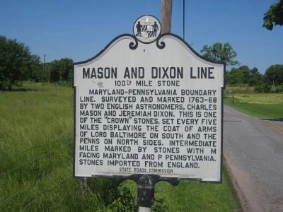
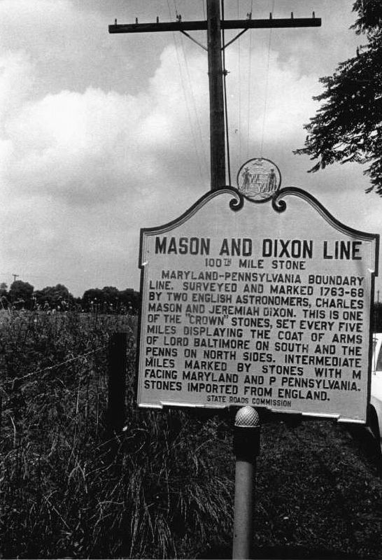
Inscription. Maryland-Pennsylvania boundary line. Surveyed and marked 1763-68 by two English astronomers, Charles Mason and Jeremiah Dixon. This is one of the "Crown" stones, set every five miles displaying the coat of arms of Lord Baltimore on south and Penns on north sides. Intermediate miles marked by stones with M facing Maryland and P Pennsylvania. Stones imported from England.
 
Erected by State Roads Commission.
 
Topics. This historical marker is listed in this topic list: Colonial Era.
 
Location. Marker has been reported missing. It was located near 39° 43.245′ N, 77° 40.365′ W. Marker was near Reid, Maryland, in Washington County. Marker was on Marsh Road, 0 miles east of Marsh Pike, on the right when traveling east. Touch for map. Marker was at or near this postal address: 16087 Marsh Rd, Hagerstown MD 21742, United States of America. Touch for directions.
 
Other nearby markers. At least 8 other markers are within 4 miles of this location, measured as the crow flies. The Long Meadow (approx. 1.9 miles away); Paradise Manor (approx. 2.2 miles away); Gettysburg Campaign (approx. 2.9 miles away in Pennsylvania); Leitersburg Bridge No. 2 (approx. 3 miles away); Erected in Honor of the Boys of Leitersburg District
Paid Advertisement
Click on the ad for more information.
Please report objectionable advertising to the Editor.
Click or scan to see
this page online
(approx. 3.3 miles away); Retreat into Maryland (approx. 3˝ miles away); a different marker also named Gettysburg Campaign (approx. 3˝ miles away); Good-Hartle Farm (approx. 3.6 miles away).
 
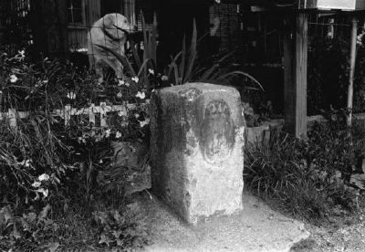
Mason and Dixon Line Marker image. Click for full size.
Paula Stoner Dickey - Maryland Historical Trust (Historic Sites Survey), June 1974
2. Mason and Dixon Line Marker
Mason and Dixon Line Marker image. Click for full size.
Photographed By F. Robby, June 2, 2008
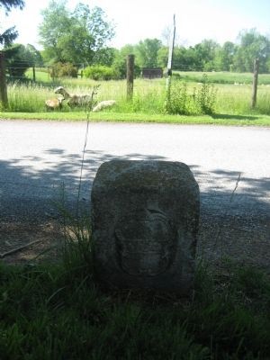
3. Mason and Dixon Line Marker
Roadside view of the marker, complete with farm animals.
The Mile Stone image. Click for full size.
Maryland Historical Trust (Historic Sites Survey)
4. The Mile Stone
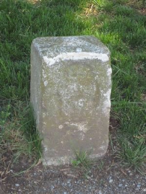
Mason and Dixon Line Stone image. Click for full size.
Photographed By F. Robby, June 2, 2008
5. Mason and Dixon Line Stone
The North (Pennsylvania) side of the stone, which sits across the road from the historical marker.
Mason and Dixon Stone image. Click for full size.
Photographed By F. Robby, June 2, 2008
6. Mason and Dixon Stone
South (Maryland) side of the stone with Lord Baltimore's coat of arms.
 
 
Credits. This page was last revised on February 16, 2022. It was originally submitted on March 10, 2008, by Christopher Busta-Peck of Shaker Heights, Ohio. This page has been viewed 1,898 times since then and 23 times this year. Last updated on February 12, 2022. Photos:   1. submitted on June 3, 2008, by F. Robby of Baltimore, Maryland.   2. submitted on March 10, 2008, by Christopher Busta-Peck of Shaker Heights, Ohio.   3. submitted on June 3, 2008, by F. Robby of Baltimore, Maryland.   4. submitted on March 10, 2008, by Christopher Busta-Peck of Shaker Heights, Ohio.   5, 6. submitted on June 3, 2008, by F. Robby of Baltimore, Maryland. • Devry Becker Jones was the editor who published this page.
Share this page.  
Share on Tumblr
m=191941

CeraNet Cloud Computing sponsors the Historical Marker Database.
This website earns income from purchases you make after using our links to Amazon.com. We appreciate your support.
Paid Advertisements
Mar. 18, 2024