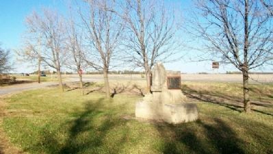
Near Hesston in Harvey County, Kansas — The American Midwest (Upper Plains)
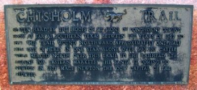
Chisholm Trail
Beaten hard by the hoofs of millions of Longhorns coming from as far as southern Texas between the years of 1867 to 1871 this trail wound northward approximately one half mile east of here. In one year alone over 600,000 cattle were herded north over this trail to the railhead at Abilene for Eastern markets. The Santa Fe coming to Newton in 1871 made Newton the Cow Capital of the Midwest.
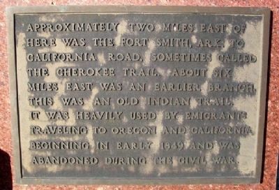
Approximately two miles east of here was the Fort Smith, Ark. to California Road, sometimes called the Cherokee Trail. About six miles east was an earlier branch. This was an old Indian trail. It was heavily used by emigrants traveling to Oregon and California beginning in early 1849 and was abandoned during the Civil War.
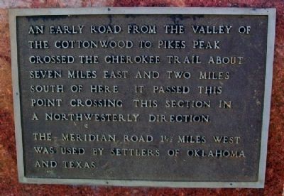
An early road from the valley of the Cottonwood to Pikes Peak crossed the Cherokee Trail about seven miles east and two miles south of here. It passed this point crossing this section in a northwesterly direction.
The Meridian Road 1˝ miles west was used by settlers of Oklahoma and Texas.
Erected 1970 by The Harvey County Historical Society.
Topics and series. This historical marker is listed in these topic lists: Animals • Roads & Vehicles • Settlements & Settlers. In addition, it is included in the Kansas, Harvey County Historical Society series list. A significant historical year for this entry is 1867.
Location. 38° 10.058′ N, 97° 20.588′ W. Marker is near Hesston, Kansas, in Harvey County. Marker is on Kansas Route 15, 0.8 miles north of NE 96th Street, on the left when traveling north. Marker is at a roadside pulloff, about four miles northeast of Hesston. Touch for map. Marker is in this post office area: Newton KS 67114, United States of America. Touch for directions.
Other nearby markers. At least 8 other markers are within 9 miles of this marker, measured as the crow flies. The Hesston Hardware Building (approx. 5.2 miles away); Hesston (approx. 5.2 miles away); Turkey Red Wheat (approx. 5.9 miles away); The Mennonites in Kansas (approx. 6˝ miles away); Banman Wheat Threshing Stone (approx. 6˝ miles away); The Harvey County Courthouse (approx. 8 miles away); First Presbyterian Church (approx. 8 miles away); Coastal Defense Cannon (approx. 8.1 miles away). Touch for a list and map of all markers in Hesston.
Also see . . .
1. The Chisholm Trail – Herding the Cattle. Legends of America website entry (Submitted on December 31, 2021, by Larry Gertner of New York, New York.)
2. The Cherokee Trail. Website homepage (Submitted on November 15, 2012, by William Fischer, Jr. of Scranton, Pennsylvania.)
3. California National Historic Trail. National Park Service website entry (Submitted on November 15, 2012, by William Fischer, Jr. of Scranton, Pennsylvania.)
4. Oregon National Historic Trail. National Park Service website entry (Submitted on November 15, 2012, by William Fischer, Jr. of Scranton, Pennsylvania.)
Additional commentary.
1. Stone Work
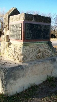
The stone work used in this marker was originally part of the Harvey County Courthouse that was demolished in the 60s.
— Submitted May 3, 2014, by Tim Fillmon of Webster, Florida.
Credits. This page was last revised on February 7, 2024. It was originally submitted on November 14, 2012, by William Fischer, Jr. of Scranton, Pennsylvania. This page has been viewed 553 times since then and 29 times this year. Photos: 1, 2, 3, 4, 5. submitted on November 15, 2012, by William Fischer, Jr. of Scranton, Pennsylvania.
