Near Mentone in Loving County, Texas — The American South (West South Central)
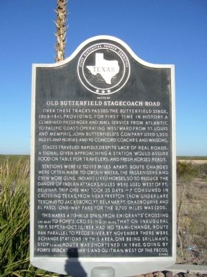
Route of Old Butterfield Stagecoach Road
Stages traveled rapidly, despite lack of real roads. A signal given approaching a station would assure food on table for travelers, and fresh horses ready.
Stations were 12 to 113 miles apart. Route changes were often made to obtain water. The passengers and crew wore guns. Indians liked horses, so to reduce the danger of Indian attacks, mules were used west of Ft. Belknap. Trip one way took 25 days - 7 consumed in crossing Texas, from near Preston (now under Lake Texoma) to Jacksboro, Ft. Belknap, Ft. Chadbourne, and El Paso. One-way fare for the 2,700 miles was $200.
This marks a 113-mile span, from Emigrants' Crossing (82 mi. S) to Pope's Crossing (31 mi. N), that on inaugural trip, Sept. 16-Oct. 12, 1858, had no team-change. Route ran parallel to Pecos River. By November there were 3 change stations in this area, one being Skillman's Stop (6 mi. N). Route was shortened in 1860, going by Forts Stockson, Davis and Quitman, west of the Pecos.
Erected 1968 by State Historical Survey Committee. (Marker Number 9460.)
Topics and series. This historical marker is listed in these topic lists: Roads & Vehicles • Settlements & Settlers. In addition, it is included in the Butterfield Overland Mail series list. A significant historical month for this entry is September 1860.
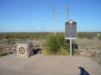
Location. 31° 42.066′ N, 103° 36.214′ W. Marker is near Mentone, Texas, in Loving County. Marker is on State Highway 302, 0.4 miles west of Pecos Street (County Road 300), on the right when traveling west. Touch for map. Marker is in this post office area: Mentone TX 79754, United States of America. Touch for directions.
Other nearby markers. At least 5 other markers are within walking distance of this marker. Goodnight-Loving Trail (here, next to this marker); Mentone (approx. half a mile away); Loving County (approx. half a mile away); Mentone Community Church (approx. half a mile away); Oliver Loving, C.S.A. (approx. half a mile away).
Credits. This page was last revised on June 16, 2016. It was originally submitted on November 21, 2012, by Bill Kirchner of Tucson, Arizona. This page has been viewed 865 times since then and 73 times this year. Photos: 1, 2. submitted on November 21, 2012, by Bill Kirchner of Tucson, Arizona. • Bernard Fisher was the editor who published this page.

