Old Town in Alexandria, Virginia — The American South (Mid-Atlantic)
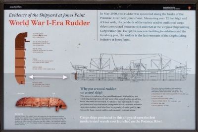
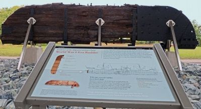
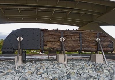
World War I-Era Rudder
Evidence of the Shipyard at Jones Point
Why put a wood rudder on a steel ship?
The answer is unknown, but modifications to shipbuilding and outfitting during times of war were often completed on an ad hoc basis, and were not recorded. A rudder of this type may have been pre-fabricated by a contractor, using more readily available materials. A wooden rudder could also have been produced more quickly, was less costly than a metal rudder, and was easier to repair at sea.
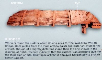
Rudder
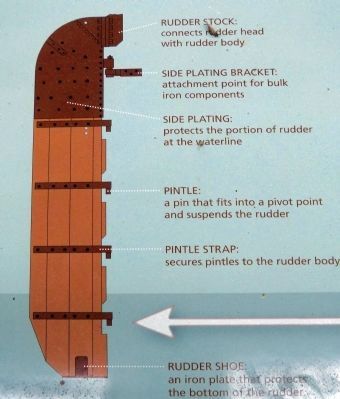
Workers found the rudder while driving piles for the Woodrow Wilson Bridge. Once pulled from the mud, archaeologists and historians studied the artifact. Though of slightly different shape than the one shown in the diagram at right, research indicates that the rudder is an alternate style for the ships built on site. This fragile artifact is displayed horizontally to provide better support.
Cargo ships produced by this shipyard were the first modern steel vessels ever launched on the Potomac River.
Erected by National Park Service.
Topics. This historical marker is listed in these topic lists: War, World I • Waterways & Vessels. A significant historical month for this entry is May 2000.
Location. 38° 47.563′ N, 77° 2.484′ W. Marker is in Alexandria, Virginia. It is in Old Town. Marker can be reached from Jones Point Drive, 0.2 miles east of South Royal Street, on the right when traveling east. The marker is under the Woodrow Wilson Bridge in front of the visitors center at Jones Point Park. Touch for map. Marker is in this post office area: Alexandria VA 22314, United States of America. Touch for directions.
Other nearby markers. At least 8 other markers are within walking distance of this marker. Potomac Connections (within shouting distance of this marker); Mount Vernon Trail (within shouting distance of this marker); Welcome to Jones Point Park (within shouting distance of this marker); A World War I Shipyard Transforms Jones Point (within shouting distance of this marker); Prehistory to Colonial Settlement (about 300 feet away, measured in a direct line); The Emerging Nation (about 300 feet away); World Wars to the Present (about 300 feet away); The First People on Jones Point (about 400 feet away). Touch for a list and map of all markers in Alexandria.
Credits. This page was last revised on January 28, 2023. It was originally submitted on December 18, 2012, by Allen C. Browne of Silver Spring, Maryland. This page has been viewed 978 times since then and 37 times this year. Photos: 1, 2, 3, 4. submitted on December 18, 2012, by Allen C. Browne of Silver Spring, Maryland. 5, 6. submitted on December 19, 2012, by Allen C. Browne of Silver Spring, Maryland. • Bernard Fisher was the editor who published this page.
