Near Jeffrey City in Fremont County, Wyoming — The American West (Mountains)
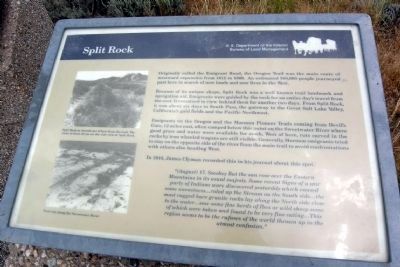
Split Rock
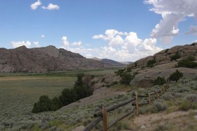
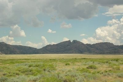
Because of its unique shape, Split Rock was a well known trail landmark and navigation aid. Emigrants were guided by the rock for an entire day's travel from the east. It remained in view behind them for another two days. From Split Rock, it was about six days to South Pass, the gateway to the Great Salt Lake Valley, California's gold fields and the Pacific Northwest.
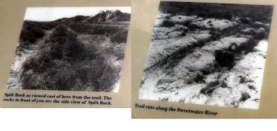
Emigrants on the Oregon and the Mormon Pioneer Trails coming from Devil's Gate, 12 miles east, often camped below this point on the Sweetwater River where good grass and water were available for stock. West of here, ruts carved in the rocks by iron wheeled wagons are still visible. Generally, Mormon emigrants tried to stay on the opposite side of the river from the main trail to avoid confrontations with other also heading West.
In 1844, James Clyman recorded this in his journal about this spot.
"(August) 17. Smokey But the sun rose over the Eastern mountains in its usual majesty. Some recent Signs of a war party of Indians ware discovered yestarddy which caused some uneasiness...roled up the Stream on the South Side...the most rugged bare granite rocks lay along the North side close to the water...saw some fine herds of Ibex or wild sheep some of which were taken and found to be very fine eating...This region seems to be the refuses of the world thrown up in the utmost confusion."
Erected by Bureau of Land Management.
Topics and series. This historical marker is listed in these topic lists: Roads & Vehicles • Settlements & Settlers. In addition, it is included in the California Trail, the Mormon Pioneer Trail, and the Oregon Trail series lists. A significant historical year for this entry is 1812.
Location. 42° 27.221′ N, 107° 32.767′ W. Marker is near Jeffrey City, Wyoming, in Fremont County. Marker can be reached from U.S. 287, one mile west of California Emigrant Rd, on the right when traveling west. Marker is located at a BLM interpretive pullout on the north side of US Route 287 approx. 16 miles east of Jeffrey City and approx. 8 miles northwest of State Route 220. Touch for map. Marker is in this post office area: Jeffrey City WY 82310, United States of America. Touch for directions.
Other nearby markers. At least 7 other markers are within 9 miles of this marker, measured as the crow flies. Wild Horses (here, next to this marker); Trails to Opportunity (here, next to this marker); Split Rock Meadows (within shouting distance of this marker); a different marker also named Split Rock (within shouting distance of this marker); Pony Express (within shouting distance of this marker); a different marker also named Split Rock (approx. 3.2 miles away); Muddy Gap (approx. 8.2 miles away).
Credits. This page was last revised on June 16, 2016. It was originally submitted on December 23, 2012, by Duane Hall of Abilene, Texas. This page has been viewed 965 times since then and 45 times this year. Photos: 1, 2, 3, 4. submitted on December 23, 2012, by Duane Hall of Abilene, Texas. • Bill Pfingsten was the editor who published this page.
Editor’s want-list for this marker. Photos with wide-view of marker and surroundings. • Can you help?


