Marceline in Linn County, Missouri — The American Midwest (Upper Plains)
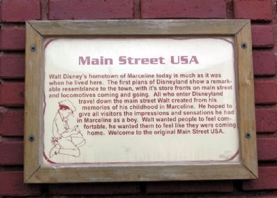
Main Street USA
Topics. This historical marker is listed in this topic list: Roads & Vehicles.
Location. 39° 42.897′ N, 92° 57.038′ W. Marker is in Marceline, Missouri, in Linn County. Marker can be reached from the intersection of North Main Street and West Ritchie Avenue. Main St is also known as Kansas Ave. Touch for map. Marker is at or near this postal address: 116 North Main Street, Marceline MO 64658, United States of America. Touch for directions.
Other nearby markers. At least 8 other markers are within walking distance of this marker. Confectionery (within shouting distance of this marker); Zurchers (within shouting distance of this marker); Uptown Theater (within shouting distance of this marker); Allen Hotel (within shouting distance of this marker); Walt Disney Post Office (within shouting distance of this marker); World Wars Memorial (about 300 feet away, measured in a direct line); Santa Fe 2546 (about 400 feet away); E.P. Ripley Park (about 600 feet away). Touch for a list and map of all markers in Marceline.
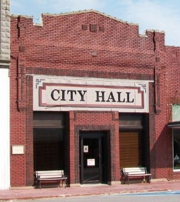
More about this marker. Marker is affixed to the face of the northwest wall of the City Hall building approx. 100 feet southwest of W. Ritchie Ave.
Credits. This page was last revised on June 16, 2016. It was originally submitted on December 26, 2012, by Duane Hall of Abilene, Texas. This page has been viewed 395 times since then and 7 times this year. Photos: 1, 2. submitted on December 26, 2012, by Duane Hall of Abilene, Texas. 3. submitted on July 30, 2013, by William Fischer, Jr. of Scranton, Pennsylvania. • Craig Swain was the editor who published this page.


