Near Church Road in Dinwiddie County, Virginia — The American South (Mid-Atlantic)
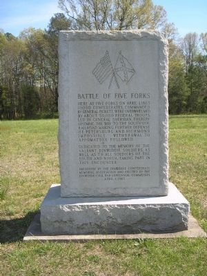
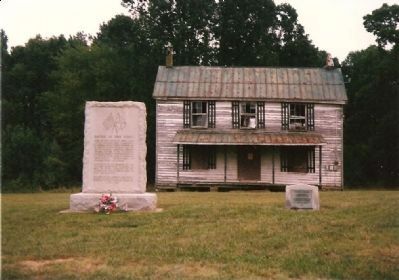
Battle of Five Forks
Here at Five Forks on April 1, 1865 10,000 Confederates, commanded by General Pickett, were overwhelmed by about 50,000 Federal troops, led by General Sheridan, thereby opening the way to the Southside Railroad making further defense of Petersburg and Richmond impossible. Withdrawal to Appomattox followed.
Dedicated to the memory of the valiant Dinwiddie soldiers, as well as to all soldiers of the South and North, taking part in this encounter.
Presented by the Dinwiddie Confederate Memorial Association and erected by the Dinwiddie Civil War Centennial Commission April 1, 1965
Erected 1965 by Dinwiddie Confederate Memorial Association and Dinwiddie Civil War Centennial Commission.
Topics and series. This historical marker is listed in this topic list: War, US Civil. In addition, it is included in the Battlefield Trails - Civil War series list. A significant historical month for this entry is April 1935.
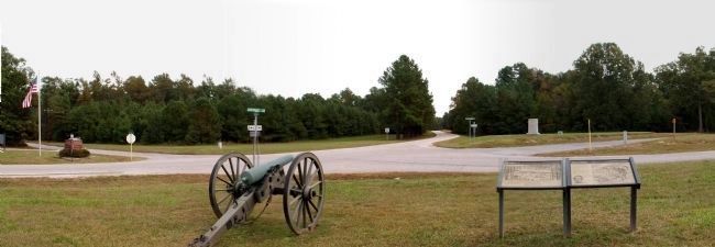
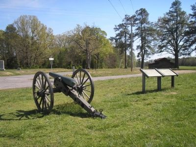
Location. 37° 8.352′ N, 77° 37.392′ W. Marker is near Church Road, Virginia, in Dinwiddie County. Marker is at the intersection of White Oak Road (Virginia Route 613) and Courthouse Road (Virginia Route 627), on the left when traveling west on White Oak Road. Marker is in the Petersburg National Battlefield, in the Five Forks Unit. It is located at the Five Forks. Touch for map. Marker is at or near this postal address: 645 Wheelers Pond Rd, Church Road VA 23833, United States of America. Touch for directions.
Other nearby markers. At least 8 other markers are within walking distance of this marker. Five Forks Battlefield (within shouting distance of this marker); "Hold Five Forks at all hazards…" (within shouting distance of this marker); Death of Pegram (within shouting distance of this marker); a different marker also named The Battle of Five Forks (within shouting distance of this marker); "Advanced…repulsed…charged again…" (approx. 0.3 miles away); Siege of Petersburg — The Linchpin is Pulled (approx. 0.3 miles away); The Siege of Petersburg (approx. 0.3 miles away); "I was exceeding anxious to attack at once…" (approx. half a mile away). Touch for a list and map of all markers in Church Road.
Related markers. Click here for a list of markers that are related to this marker. Battle of Five Forks by Markers.
Also see . . .
1. Battle of Five Forks. Wikipedia entry (Submitted on January 23, 2024, by Larry Gertner of New York, New York.)
2. Battle of Five Forks (Petersburg National Battlefield). National Park Service website entry (Submitted on March 15, 2008, by Bill Coughlin of Woodland Park, New Jersey.)
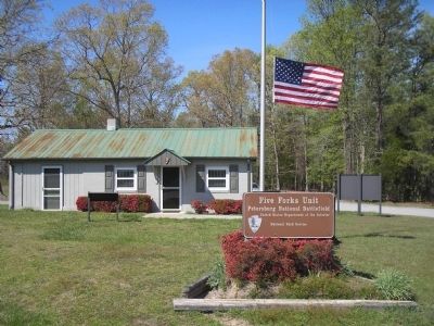
Photographed By Bill Coughlin, April 24, 2007
4. Five Forks
On April 1, 1865, Union Gen. Philip Sheridan successfully broke the Confederate line at Five Forks. The Confederates fell back to the South Side Railroad, but were eventually driven away. The fall of the South Side Railroad, Lee's last supply line, forced the evacuation of Petersburg and Richmond.
Credits. This page was last revised on January 23, 2024. It was originally submitted on March 15, 2008, by Bill Coughlin of Woodland Park, New Jersey. This page has been viewed 2,375 times since then and 42 times this year. Last updated on August 22, 2021, by Bradley Owen of Morgantown, West Virginia. Photos: 1. submitted on March 15, 2008, by Bill Coughlin of Woodland Park, New Jersey. 2. submitted on March 15, 2008, by Bryan Olson of Syracuse, New York. 3, 4. submitted on March 15, 2008, by Bill Coughlin of Woodland Park, New Jersey. 5. submitted on March 24, 2008, by Craig Swain of Leesburg, Virginia. • Devry Becker Jones was the editor who published this page.
