Near West Augusta in Augusta County, Virginia — The American South (Mid-Atlantic)
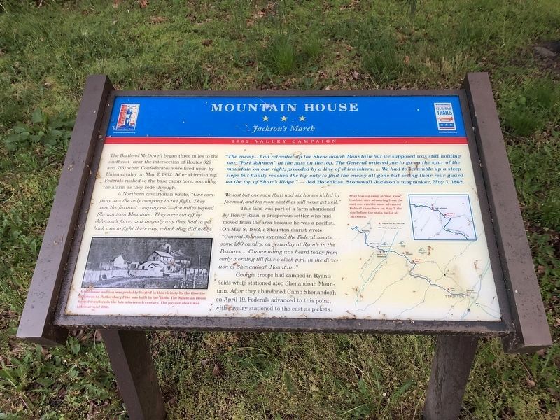
Mountain House
Jackson's March
— 1862 Valley Campaign —
The Battle of McDowell began three miles to the southeast (near the intersection of Routes 629 and 716) when Confederates were fired upon by Union cavalry on May 7, 1862. After skirmishing, Federals rushed to the base camp here, sounding the alarm as they rode through.
A Northern cavalryman wrote, “Our company was the only company in the fight. They were the furthest company out – five miles beyond Shenandoah Mountain. They were cut off by Johnson’s force, and the only way they had to get back was to fight their way, which they did nobly. We lost but one man [but] had six horses killed in the road, and ten more shot that will never get well.”
This land was part of a farm abandoned by Henry Ryan, a prosperous settler who had moved from the area because he was a pacifist. On May 8, 1862, a Staunton diarist wrote, “General Johnson surprised the Federal scouts, some 200 cavalry, on yesterday at Ryan’s in the Pastures… Cannonading was heard today from early morning till four o’clock p.m. in the direction of Shenandoah Mountain.”
Georgia troops had camped in Ryan’s fields while stationed atop Shenandoah Mountain. After they abandoned Camp Shenandoah on April 19, Federals advanced to this point, with cavalry stationed to the east as pickets.
“The enemy… had retreated up the Shenandoah Mountain but we supposed was still holding our ‘Fort Johnson’ at the pass on the top. The General ordered me to go up the spur of the mountain on our right, preceded by a line of skirmishers…. We had to scramble up a steep slope but finally reached the top only to find the enemy all gone but seeing their rear guard on the top of Shaw’s Ridge.” – Jed Hotchkiss, Stonewall Jackson’s mapmaker, May 7, 1862.
Erected by Shenandoah Valley Battlefields Foundation and Virginia Civil War Trails.
Topics and series. This historical marker is listed in this topic list: War, US Civil. In addition, it is included in the Virginia Civil War Trails series list. A significant historical month for this entry is April 1819.
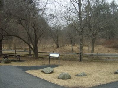
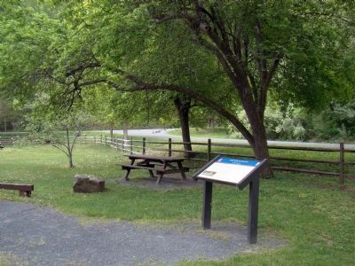
Location. 38° 18.377′ N, 79° 21.741′ W. Marker is near West Augusta, Virginia, in Augusta County. Marker is at the intersection of Shenandoah Mountain Drive (U.S. 250) and Ramsey's Draft North, on the right when traveling west on Shenandoah Mountain Drive. Marker is in a picnic park. Vehicle parking is inside the park. Touch for map. Marker is in this post office area: West Augusta VA 24485, United States of America. Touch for directions.
Other nearby markers. At least 8 other markers are within 2 miles of this marker, measured as the crow flies. “… to go wee did not know where” (approx. 1.1 miles away); “We had a hardscrabble up…” (approx. 1.2 miles away); “Wee are now looking out for a fight…” (approx. 1.2 miles away); “Wee are faring badly…” (approx. 1.2 miles away); Fort Edward Johnson (approx. 1.2 miles away); Healing the Wounds (approx. 1.2 miles away); “It was cold business…” (approx. 1.2 miles away); a different marker also named Fort Edward Johnson (approx. 1.2 miles away). Touch for a list and map of all markers in West Augusta.
More about this marker. In the lower left is a photo of this section of road. A toll house and inn was probably located in this vicinity by the time the Staunton-to-Parkersburg Pike was built in the 1830s. The Mountain House hosted travelers in the late nineteenth century. The picture above taken around 1900.
On the right is a set of maps indicating the location of the marker and other Civil War related sites. After leaving camp at West View, Confederates advancing from the east overran the most advanced Federal camp here on May 7, the day before the main battle at McDowell.
Credits. This page was last revised on May 8, 2021. It was originally submitted on March 4, 2009, by Robert H. Moore, II of Winchester, Virginia. This page has been viewed 1,944 times since then and 34 times this year. Last updated on January 30, 2013, by David Graff of Halifax, Nova Scotia. Photos: 1. submitted on May 8, 2021, by Devry Becker Jones of Washington, District of Columbia. 2. submitted on March 4, 2009, by Robert H. Moore, II of Winchester, Virginia. 3. submitted on May 5, 2010, by J. J. Prats of Powell, Ohio. • Bill Pfingsten was the editor who published this page.


