Dumbo in Brooklyn in Kings County, New York — The American Northeast (Mid-Atlantic)
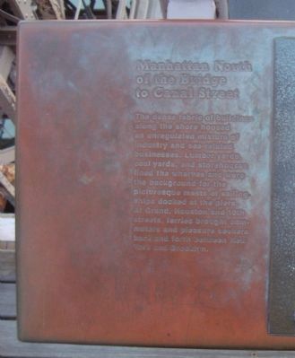
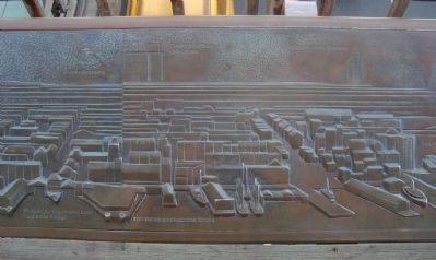
Manhattan North of the Bridge to Canal Street
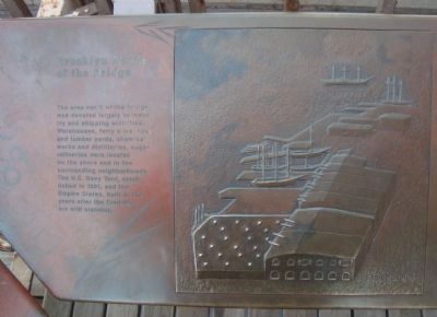
Brooklyn North of the Bridge
Inscription.
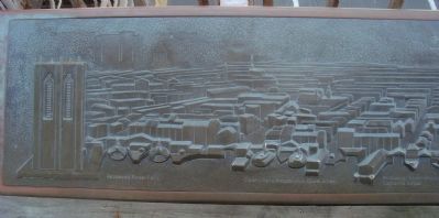
The dense fabric of buildings along the shore housed an unregulated mixture of industry and sea-related businesses. Lumber yards, coal yards, and storehouses lined the wharves and were the background for the picturesque masts of sailing ships docked at the piers. At Grand, Houston and 10th streets, ferries brought commuters and pleasure seekers back and forth between New York and Brooklyn.
Brooklyn North of the Bridge
The area north of the bridge was devoted largely to industry and shipping activities. Warehouses, ferry slips, coal and lumber yards, chemical works and distilleries, sugar refineries were located on the shore and in surrounding neighborhoods. The U.S. Navy Yard, established in 1801, and the Empire Stores, built in the years after the Civil War, are still standing.
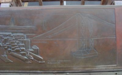
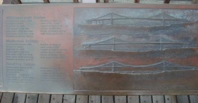
Williamsburgh Bridge
Construction begun: 1896
Open to traffic: December 19, 1903
Total length: 7,306 feet
Main span: 1,668 feet
Each cable: 3,985 feet long
Diameter of cables: 18.6 in.
Number of wires in each cable: 7,896
Length of wire in all four cables: 17,404 miles
Height of towers above high water mark: 332 ft. 9 in.
Manhattan Bridge
Construction begun: 1901
Open to traffic: December 31, 1909
Total length: 6,855 feet
Main span: 1,470 feet long
Each cable: 3,223 feet long
Diameter of cables: 21 1/4 in.
Number of wires in each cable: 3,463
Length of wire in all four cables: 23,232 miles
Height of towers above high water mark: 336 ft
Brooklyn Bridge
Construction begun: 1869
Open to traffic: May 24, 1883
Total length: 8,016 feet
Main span: 1,595 1/2 feet
Each cable: 3,578 feet long
Diameter of cables: 15 3/4 in.
Number of wires in each cable: 5,383
Length of wire in all four cables: 14,357 miles
Height of towers above high water mark: 272 feet
Erected by The 1983 Brooklyn Bridge Centennial Commission.
Topics. This historical marker is listed in these topic lists: Bridges & Viaducts • Industry & Commerce • Waterways & Vessels. A significant historical date for this entry is May 24, 1883.
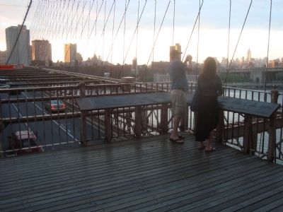
Location. 40° 42.254′ N, 73° 59.66′ W. Marker is in Brooklyn, New York, in Kings County. It is in Dumbo. Marker can be reached from Brooklyn Bridge Promenade. This marker is located on the Brooklyn Bridge Promenade at the southeast tower, facing Manhattan. Touch for map. Marker is in this post office area: Brooklyn NY 11201, United States of America. Touch for directions.
Other nearby markers. At least 8 other markers are within walking distance of this marker. The Brooklyn Bridge (a few steps from this marker); The Builders of the Bridge
Photographed By Barry Swackhamer, May 20, 2012
2. Manhattan North of the Bridge to Canal Street Marker
Captions (left to right): Roosevelt Street; S. Court House; St. John’s Church; Clyde Line to Philadelphia Oliver Street: Bridgeport Steamship Line, Catherine Street; Brooks Brothers; Iron Works and Machine Shops; Confucius Plaza, Chinatown; Empire State Building; Seamans Exchange; Chrysler Building; Pier 56 N.Y and New Sectors Steamship Line; Manhattan Bridge built 1898.
More about this marker. This marker is in two panels placed at right-angle to each other. It is too large for a readable image to photographed in one picture, thus a series of pictures are presented to be viewed 1-7 (left to right).
Photographed By Barry Swackhamer, May 20, 2012
7. Manhattan North of the Bridge to Canal Street Marker
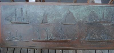
Captions: A fast cargo sailing ship “The Sea Witch” 1872; A side wheeler towboat; A lighter ship used to transport goods within the harbor; A steamer rigged as three masted schooner. Part of Revenue Cutter Service the forerunner of the Coast Guard; A river passenger ferryboat, “The Robert Fulton”; A paddle steamer passenger ship, “The City of Brockton”.
Credits. This page was last revised on January 31, 2023. It was originally submitted on January 30, 2013, by Barry Swackhamer of Brentwood, California. This page has been viewed 579 times since then and 23 times this year. Photos: 1, 2, 3, 4, 5, 6, 7, 8. submitted on January 30, 2013, by Barry Swackhamer of Brentwood, California. • Bill Pfingsten was the editor who published this page.
