Vienna in Dorchester County, Maryland — The American Northeast (Mid-Atlantic)
Discover: The Nanticoke
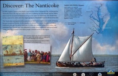
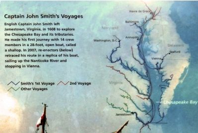
In 1608, English Captain John Smith's explorations of the Chesapeake Bay led him up the Nanticoke River. He may have felt as if he were exploring the New World, but the Native Americans he encountered had been living in the region for millennia. The Nanticokes, as they came to be called, were the largest group on Maryland's Eastern Shore at the time.
The Nanticokes were governed by a paramount chief whose main town, north of Vienna, became known as Chicone. As the number of colonists increased, European practices conflicted with age-old native traditions. In 1698, the Chicone Indian Reservation was established by 70 years later was disbanded as many of its inhabitants had moved away. Today some descendants of the native people continue to live in the region.
Erected by Chesapeake Bay Gateways Network.
Topics. This historical marker is listed in these topic lists: Exploration • Native Americans. A significant historical year for this entry is 1608.
Location. 38° 28.982′ N, 75° 49.402′ W. Marker is in Vienna, Maryland, in Dorchester County. Marker is on Water Street, on the right when traveling north. Marker at the north end of the park along Water Street. Touch for map. Marker is in this post office area: Vienna MD 21869, United States of America. Touch for directions.
Other nearby markers. At least 8 other markers are within 2 miles of this marker, measured as the crow flies. Discover: Vienna (here, next to this marker); Discover: Restoration (a few steps from this marker); A walking tour of Vienna (within shouting distance of this marker); Discover: The Shoreline (about 400 feet away, measured in a direct line); John Smith Explores the Chesapeake (approx. 0.2 miles away); Discover: Vienna Heritage (approx. 0.2 miles away); Unnacokossimmon (approx. 0.4 miles away); The Nanticoke Historic Preservation Alliance (approx. 1.9 miles away). Touch for a list and map of all markers in Vienna.
Also see . . . John Smith shallop to stop at Vienna. From the Star Democrat, Wednesday, May 30, 2007 (Submitted on February 14, 2013, by Allen C. Browne of Silver Spring, Maryland.)
Photographed By Allen C. Browne, February 9, 2013
5. Native Americans
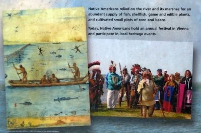
Native Americans relied on the river and its marshes for an abundant supply of fish, shellfish, game and edible plants, and cultivated small plots of corn and beans.
Today, Native Americans hold an annual festival in Vienna to participate in local heritage events.
Today, Native Americans hold an annual festival in Vienna to participate in local heritage events.
Credits. This page was last revised on January 15, 2022. It was originally submitted on February 14, 2013, by Allen C. Browne of Silver Spring, Maryland. This page has been viewed 403 times since then and 20 times this year. Photos: 1, 2, 3, 4, 5. submitted on February 14, 2013, by Allen C. Browne of Silver Spring, Maryland. • Bill Pfingsten was the editor who published this page.
