Near Fort Oglethorpe in Catoosa County, Georgia — The American South (South Atlantic)
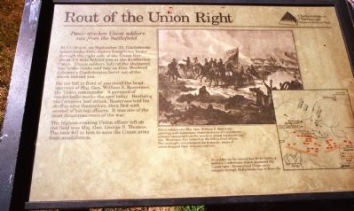
Rout of the Union Right
Panic-stricken Union soldiers ran from the battlefield
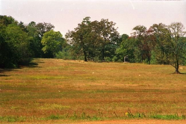
On the hill in front of you stood the headquarters of Major General William S. Rosecrans, the Union commander. A pyramid of cannonballs marks the spot today. Realizing that disaster had struck, Rosecrans told his staff to save themselves, then fled with several of his top officers. It was one of the most disastrous routs of the war.
The highest ranking Union officer left on the field was Major General George S. Thomas. The task fell to him to save the Union Army from annihilation.
Erected by Chickamauga and Chattanooga National Military Park.
Topics. This historical marker is listed in this topic list: War, US Civil. A significant historical month for this entry is September 1850.
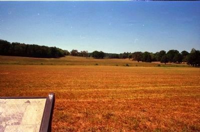
Location. 34° 54.94′ N, 85° 15.964′ W. Marker is near Fort Oglethorpe, Georgia, in Catoosa County. Marker is on Glenn-Kelly Road, half a mile north of Vittletoe-Chickamauga Road, on the left when traveling north. The marker is across the road from a parking pulloff for about six cars. The marker looks out toward a large open field surrounded by forest. Touch for map. Marker is in this post office area: Fort Oglethorpe GA 30742, United States of America. Touch for directions.
Other nearby markers. At least 8 other markers are within walking distance of this marker. Battery G, 1st Ohio Light Artillery (within shouting distance of this marker); a different marker also named Battery G, 1st Ohio Light Artillery (within shouting distance of this marker); Battery M, 1st Ohio Light Artillery (within shouting distance of this marker); 88th Indiana Infantry (about 400 feet away, measured in a direct line); Stewart's Division (about 500 feet away); 42nd Indiana Infantry (about 500 feet away); J. Beatty's Brigade (about 500 feet away); 19th Illinois Infantry (about 500 feet away). Touch for a list and map of all markers in Fort Oglethorpe.
More about this marker. The marker has the following images:
Drawing Right: Union commander Major General William S. Rosecrans (pointing with binoculars) observes waves of Confederate infantry emerging from the woods to attack his dissolving line. Rosecrans was located on the hill in front of you. The onslaught overwhelmed the Federals, many of whom dropped their weapons and ran.
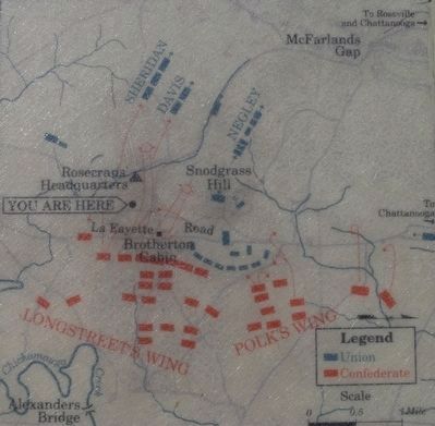
Map Right: At midday on the second day of battle, a massive Confederate attack shattered the Union right. Demoralized Union units escaped through McFarland's Gap to Rossville.
Credits. This page was last revised on June 16, 2016. It was originally submitted on February 20, 2013, by David Graff of Halifax, Nova Scotia. This page has been viewed 582 times since then and 7 times this year. Photos: 1. submitted on February 20, 2013, by David Graff of Halifax, Nova Scotia. 2. submitted on August 19, 2015, by Brandon Fletcher of Chattanooga, Tennessee. 3, 4. submitted on February 20, 2013, by David Graff of Halifax, Nova Scotia. • Craig Swain was the editor who published this page.


