Bluffton in Wells County, Indiana — The American Midwest (Great Lakes)
Pickett's Run
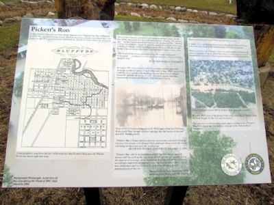
Neither Pickett's Run nor any other stream appears in the Original Plat Map of Bluffton of 1839. The only known map of early Bluffton depicting a stream, reproduced here, was printed in the 1876 ILLUSTRATED HISTORICAL ATLAS OF THE STATE OF INDIANA.
This natural waterway proved too convenient as an open sewer. By the late 1800s, newspaper accounts referred to Pickett's Run as "The old eyesore." A City Council tour of the stream in the summer of 1891 "found it in a horrid condition" caused by property owners draining and throwing filth into the stream, which included a couple of hog pens built over the stream. Council ordered the Street Commissioner to clean Pickett's Run.
"The health of the entire population along the stream was greatly endangered ... as almost every day develops new cases of typhoid fever along the Run."
BLUFFTON WEEKLY CHRONICLE
In August 1891, City Council voted 4-3 to create sanitary and storm sewerage systems to replace Pickett's Run and, in June 1894, voted 4-3 to build the sewer systems, the deciding vote cast both times by Mayor Martin W. Walbert. By spring of 1897, the sewer systems had been substantially finished, and Pickett's Run had been filled in.
"Pickett's Run is being rapidly wiped out of existence and soon where an odorous little stream stole through back yards and along streets the sewer will hump its back and carry. the water away."
BLUFFTON WEEKLY CHRONICLE (November 11, 1896)
"Pickett's Run with its accumulation of filth had become a source of disease and the earth in the rear of our dwellings was sour and foul from the deposits of sewerage on the surface of the ground. Common Council accordingly undertook the task of correcting the evil, and Pickett's Run is now obliterated, and sewers pass by each lot in the more densely populated part of the city."
Mayor James B. Hale, September 1898,
addressing new Mayor and City Council
The townsfolk buried Pickett's Run and built houses on it.
In March 1913, the Wabash River came looking for its buried tributary with a 100-year flood. Folks weathered the flood and cleaned up.
Ninety years later, all of Pickett's Run was resurrected by a flash flood prior to midnight of July 4, 2003 followed by a week-long flood which reclaimed the lower end of this forgotten tributary of the Wabash River.
By early 2005, most of the houses built in the lower end of Pickett's Run had been bought by the City and torn down.
This area is now maintained as green space, a tribute to how Pickett's Run both shaped our City and is a vital part of the Wabash River floodplain.
Erected by City of Bluffton and The Wells County Foundation.
Topics. This historical marker is listed in these topic lists: Disasters • Environment • Settlements & Settlers. A significant historical month for this entry is March 1913.
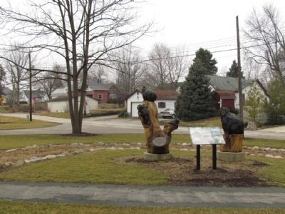
Location. 40° 44.343′ N, 85° 10.011′ W. Marker is in Bluffton, Indiana, in Wells County. Marker can be reached from E. Market St, 0.1 miles west of Wayne St. Marker is located at west end of Pickett's Run Park. Touch for map. Marker is in this post office area: Bluffton IN 46714, United States of America. Touch for directions.
Other nearby markers. At least 8 other markers are within walking distance of this marker. Charles C. Deam (about 400 feet away, measured in a direct line); Bluffton Mill Race (approx. 0.2 miles away); Wells County Courthouse (approx. ¼ mile away); Sgt. William Bumparner (approx. ¼ mile away); Wells County 1862 Cannon - Civil War (approx. ¼ mile away); Wells County War on Terrorism Honor Roll (approx. half a mile away); Wells County Veterans Honor Roll (approx. half a mile away); S. Bruce Kephart, M.D. (approx. 0.7 miles away). Touch for a list and map of all markers in Bluffton.
Credits. This page was last revised on November 29, 2023. It was originally submitted on March 26, 2013, by Duane Hall of Abilene, Texas. This page has been viewed 667 times since then and 28 times this year. Photos: 1, 2, 3. submitted on March 26, 2013, by Duane Hall of Abilene, Texas. • Bill Pfingsten was the editor who published this page.


