Yorktown in York County, Virginia — The American South (Mid-Atlantic)
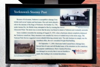
Yorktown's Stormy Past
Some residents remember the morning of August 23, 1933, when a hurricane almost completely destroyed the Yorktown waterfront. Many structures were smashed by waves or washed away in the storm surge. The National Park Service suggested owners rebuild ollowing colonial style. The only business to comply was the steamboat office, the now remodeled Freight Shed building.
On September 17, 2003, Hurricane Isabel caused heavy damage here. Several feet of water and silt flooded many of the structures on the waterfront. One popular establishment, Nick’s Seafood Pavilion, was damaged so severely that it was not feasible to repair, thus leading to its eventual demolition.
(captions)
Building damaged by the Storm of ‘33. Photo courtesy of York County.
View of the Watermen’s Museum during Hurrricane Isabel, 2003. Photo courtesy of William W. Cole, Photographer.
Erected 2010 by York County.
Topics. This historical marker is listed in these topic lists: Disasters • War, US Revolutionary. A significant historical month for this entry is September 1730.
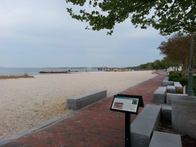
Location. 37° 14.19′ N, 76° 30.378′ W. Marker is in Yorktown, Virginia, in York County. Marker can be reached from Water Street west of Read Street, on the right when traveling west. Located along Yorktown's Riverwalk. Touch for map. Marker is in this post office area: Yorktown VA 23690, United States of America. Touch for directions.
Other nearby markers. At least 8 other markers are within walking distance of this marker. TransAmerica Bike Trail (here, next to this marker); Great Fire of 1814 (within shouting distance of this marker); Tobacco Inspection (within shouting distance of this marker); Yorktown Waterfront (within shouting distance of this marker); Steamboats on York River (within shouting distance of this marker); Civil War Hot-Air Balloons (within shouting distance of this marker); Yorktown’s Waterfront (about 400 feet away, measured in a direct line); Pirates in Yorktown? (about 400 feet away). Touch for a list and map of all markers in Yorktown.
Credits. This page was last revised on November 14, 2021. It was originally submitted on April 21, 2013, by Bernard Fisher of Richmond, Virginia. This page has been viewed 529 times since then and 36 times this year. Photos: 1, 2. submitted on April 21, 2013, by Bernard Fisher of Richmond, Virginia.

