Marker Logo HMdb.org THE HISTORICAL
MARKER DATABASE
“Bite-Size Bits of Local, National, and Global History”
Tiberias, Northern District, Israel — West Asia (the Levant in the Middle East)
 

The Southern Wall


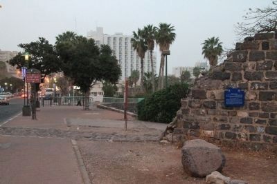
The Southern Wall Marker image. Click for full size.
Photographed By Dale K. Benington, March 8, 2013
1. The Southern Wall Marker
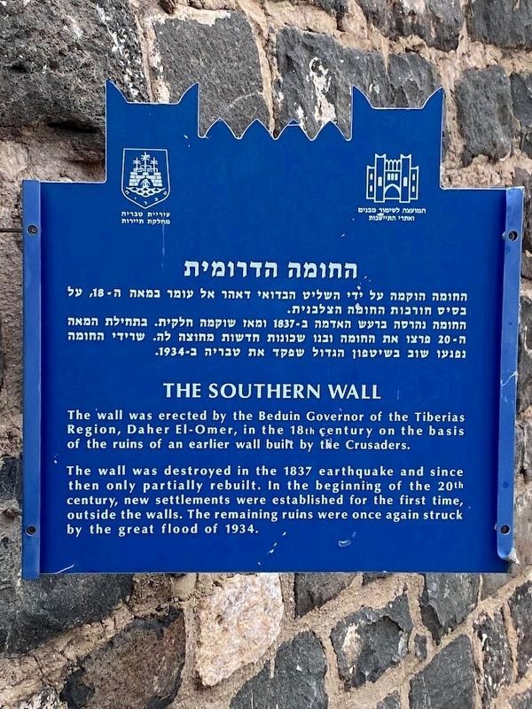
Inscription. The wall was erected by the Beduin Governor of the Tiberias Region, Daher El-Omer, in the 18th century on the basis of the ruins of an earlier wall built by the Crusaders.

The wall was destroyed in the 1837 earthquake and since then only partially rebuilt. In the beginning of the 20th century, new settlements were established for the first time, outside the walls. The remaining ruins were once again struck by the great flood of 1934.
 
Erected by The municipality of Tiberias, Tourism Department.
 
Topics. This historical marker is listed in these topic lists: Forts and CastlesMan-Made FeaturesSettlements & Settlers. A significant historical year for this entry is 1837.
 
Location. 32° 47.086′ N, 35° 32.521′ E. Marker is in Tiberias, Northern District. Marker is on HaBanim (National Route 90) close to HaGalil, on the right when traveling north. This historical marker is located on the south side of the downtown Tiberias business district, just east of an opening in the wall made for Ha Banim (Route 90), affixed to the south side of the wall. It is a short walk from the nearby Leonardo Plaza Hotel. Touch for map. Touch for directions.
 
Other nearby markers. At least 8 other markers are within walking distance of this marker. The Crusader-Ottoman Building / Millstones (within shouting distance of this marker); "Magic on the sea of galilee..." (about 90 meters away,
Paid Advertisement
Click on the ad for more information.
Please report objectionable advertising to the Editor.
Click or scan to see
this page online
measured in a direct line); Doors of Burial Caves / Burial Customs - Sarcophagi (about 90 meters away); The Synagogue (about 120 meters away); The Architecture of Tiberias (about 120 meters away); Domestic Building (about 120 meters away); Remains of the Watch Tower (approx. 0.4 kilometers away); Liberation of Tiberias Memorial (approx. half a kilometer away). Touch for a list and map of all markers in Tiberias.
 
Also see . . .  Daher el-Omar. This is a link to information provided by Wikipedia, the free encyclopedia. (Submitted on May 14, 2013, by Dale K. Benington of Toledo, Ohio.) 
 
The Southern Wall Marker image. Click for full size.
Photographed By Dale K. Benington, March 8, 2013
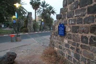
2. The Southern Wall Marker
View of the historical marker looking north along HaBanim (Route 90).
The Southern Wall Marker image. Click for full size.
Photographed By Dale K. Benington, March 8, 2013
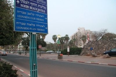
3. The Southern Wall Marker
View of the historical marker, affixed to the southern wall, looking west across HaBanim (Route 90).
The Southern Wall Marker image. Click for full size.
Photographed By Dale K. Benington, March 8, 2013
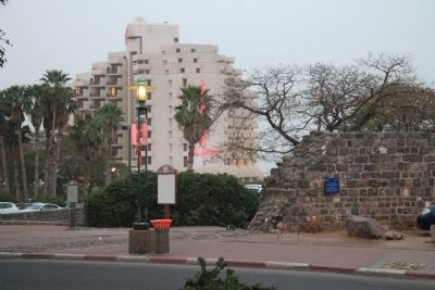
4. The Southern Wall Marker
View, looking east across the HaBanim (Route 90), of the historical marker, affixed to the southern wall, with the Leonardo Plaza Tiberias Hotel in the distant background.
The Southern Wall Marker image. Click for full size.
Photographed By Dale K. Benington, March 8, 2013
5. The Southern Wall Marker
A closer view, looking east across the HaBanim (Route 90), of the historical marker, affixed to the southern wall, with the Leonardo Plaza Tiberias Hotel in the background.
The Southern Wall Marker image. Click for full size.
Photographed By Darren Jefferson Clay, March 7, 2023
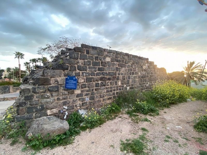
6. The Southern Wall Marker
The Southern Wall looking toward the Sea of Galilee image. Click for full size.
Photographed By Darren Jefferson Clay, March 7, 2023
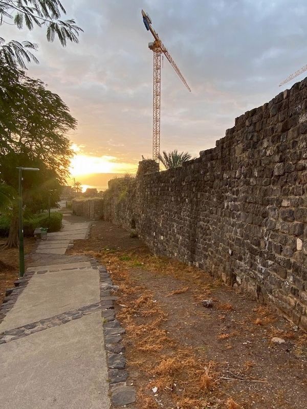
7. The Southern Wall looking toward the Sea of Galilee
The Southern Wall looking toward the Sea of Galilee image. Click for full size.
Photographed By Darren Jefferson Clay, March 7, 2023
8. The Southern Wall looking toward the Sea of Galilee
 
 
Credits. This page was last revised on May 10, 2023. It was originally submitted on May 14, 2013, by Dale K. Benington of Toledo, Ohio. This page has been viewed 486 times since then and 3 times this year. Photos:   1, 2, 3, 4, 5. submitted on May 14, 2013, by Dale K. Benington of Toledo, Ohio.   6, 7, 8. submitted on April 28, 2023, by Darren Jefferson Clay of Duluth, Georgia.
Share this page.  
Share on Tumblr
m=65326

CeraNet Cloud Computing sponsors the Historical Marker Database.
This website earns income from purchases you make after using our links to Amazon.com. We appreciate your support.
Paid Advertisements
Mar. 19, 2024