Fort Dodge in Ford County, Kansas — The American Midwest (Upper Plains)
Commanding Officer's Quarters
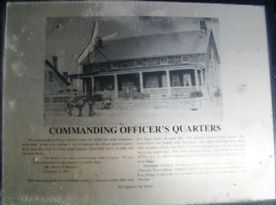
The commanding officer's quarters was one of the last stone structures to be built. In the years before it was completed the officer and his family lived near the river in a four-room dugout, three feet below ground and four feet above.
The houses are more picturesque than elegant. We are living somewhat in the manner of prairie dogs.
Mrs. Henry T. Douglas
February 3, 1867
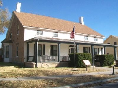
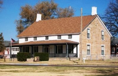
This one-and-a-half story building contains a spacious center hall with two large rooms on each side. The attached kitchen forms an ell. The lower level was heated with fireplaces. The upper story has four rooms with windows which may have served as gun ports and can be seen just above the porch line. The frame building on the right, built in the early 1870's, was an officers' quarters and its twin once stood to the left of the stone house.
The stone building has been called Custer House for many years. Although Brevet Major General George A. Custer never was stationed at Fort Dodge he did lead the Seventh Cavalry from here to the Battle of the Washita.
Not Open to the Public
Topics. This historical marker is listed in these topic lists: Forts and Castles • Wars, US Indian. A significant historical date for this entry is February 3, 1867.
Location. 37° 43.925′ N, 99° 56.165′ W. Marker is in Fort Dodge, Kansas, in Ford County. Marker is on Custer Street east of Garfield Street, on the left when traveling east. Marker is on the grounds of the Kansas Soldiers' Home. Touch for map. Marker is in this post office area: Fort Dodge KS 67843, United States of America. Touch for directions.
Other nearby markers. At least 8 other markers are within walking distance of this marker. Hospital (within shouting distance of this marker); Fort Dodge (about 300 feet away, measured in a direct line); Sutler Store (about 300 feet away); Enlisted Men's Barracks (about 300 feet away); Storehouse (about 500 feet away); Wagnor Memorial Fountain (approx. 0.2 miles away); Cemetery (approx. ¼ mile away); a different marker also named Fort Dodge (approx. ¼ mile away). Touch for a list and map of all markers in Fort Dodge.
Also see . . .
1. Fort Dodge. National Park Service website entry (Submitted on May 11, 2023, by Larry Gertner of New York, New York.)
2. Fort Dodge in Kansas Cyclopedia (1912). KSGenWeb entry (Submitted on May 19, 2013, by William Fischer, Jr. of Scranton, Pennsylvania.)
3. Kansas Soldiers' Home, Fort Dodge. Kansas Commission on Veterans' Affairs website entry (Submitted on May 19, 2013, by William Fischer, Jr. of Scranton, Pennsylvania.)
Credits. This page was last revised on May 11, 2023. It was originally submitted on May 19, 2013, by William Fischer, Jr. of Scranton, Pennsylvania. This page has been viewed 482 times since then and 21 times this year. Photos: 1, 2, 3. submitted on May 19, 2013, by William Fischer, Jr. of Scranton, Pennsylvania.


