Near Brookville in Franklin County, Indiana — The American Midwest (Great Lakes)
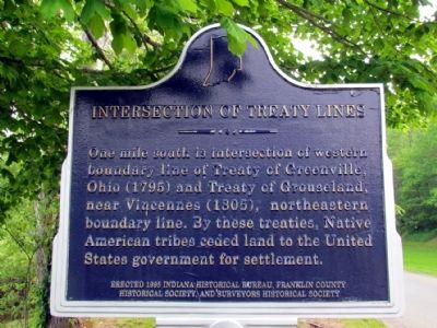
Intersection of Treaty Lines
Erected 1995 by Indiana Historical Bureau, Franklin County Historical Society, and Surveyors Historical Society. (Marker Number 24.1995.3.)
Topics and series. This historical marker is listed in these topic lists: Native Americans • Settlements & Settlers. In addition, it is included in the Indiana Historical Bureau Markers series list.
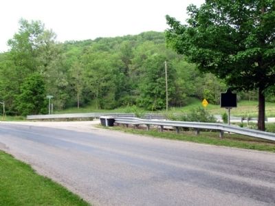
Location. 39° 24.491′ N, 85° 3.169′ W. Marker is near Brookville, Indiana, in Franklin County. Marker is at the intersection of St. Mary's Road and Castle Road, on the left when traveling west on St. Mary's Road. Marker is at south corner of intersection. Touch for map. Marker is in this post office area: Brookville IN 47012, United States of America. Touch for directions.
Other nearby markers. At least 8 other markers are within 3 miles of this marker, measured as the crow flies. Boundary Hill (approx. 1.6 miles away); David Stoops - Pioneer (approx. 2 miles away); Lock 21 and the Twin Arch Aqueduct at Yellow Bank Creek (approx. 2 miles away); The Whitewater Canal Trail Offers You: (approx. 2.1 miles away); Yellow Bank Flag Stop / Hendrickson's Ice Pond (approx. 2.1 miles away); a different marker also named The Whitewater Canal Trail Offers You: (approx. 2.1 miles away); Abram Hammond (approx. 2.3 miles away); Brookville, Franklin County (approx. 2.3 miles away). Touch for a list and map of all markers in Brookville.
Credits. This page was last revised on June 16, 2016. It was originally submitted on July 19, 2013, by Duane Hall of Abilene, Texas. This page has been viewed 497 times since then and 19 times this year. Photos: 1, 2. submitted on July 19, 2013, by Duane Hall of Abilene, Texas. • Bill Pfingsten was the editor who published this page.

