South of Broad in Charleston in Charleston County, South Carolina — The American South (South Atlantic)
In Search of the Walled City
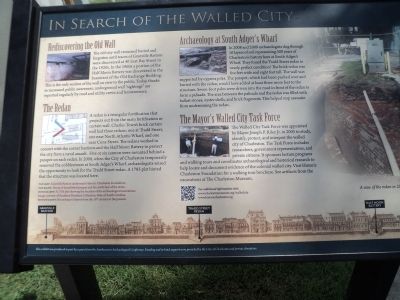
Rediscovering the Old Wall
The old city wall remained buried and forgotten until traces of Granville Bastion were discovered at 40 East Bay Street in the 1920s. In the 1960s a portion of the Half Moon Battery was discovered in the basement of the Old Exchange Building. This is the only section of the wall on view to the public. Today, thanks to increased public awareness, underground wall “sightings” are reported regularly by road and utility crews and homeowners.
The Redan
A redan is a triangular fortification that projects out from the main fortification or curtain wall. Charles Town’s brick curtain wall had three redans: one at Tradd Street, one near North Atlantic Wharf, and one near Cone Street. The redans worked in concert with the corner bastions and the Half Moon Battery to protect the city from a naval assault. Five or six cannon were mounted behind a parapet on each redan. In 2008, when the City of Charleston temporarily removed cobblestones at South Adger’s Wharf, archaeologists seized the opportunity to look for the Tradd Street redan. A 1785 plat hinted that the structure was located here.
Archaeology at South Adger’s Wharf
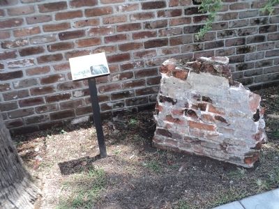
In 2008 and 2009 archaeologists dug through 10 layers of soil representing 300 years of Charleston’s history here at South Adger’s Wharf. They found the Tradd Street redan in nearly perfect condition! The brick redan was five feet wide and eight feet tall. The wall was supported by cypress piles. The parapet, which had been pushed over and buried with the redan, would have added at least three more feet to the structure. Seven-foot pales were driven into the mud in front of the redan to form a palisade. The area between the palisade and the redan was filled with ballast stones, oyster shells, and brick fragments. This helped stop seawater from undermining the redan.
The Mayor’s Walled City Task Force
The Walled City Task Force was appointed by Mayor Joseph P. Riley Jr. in 2005 to study, identify, protect, and interpret the walled city of Charleston. The Task Force includes researchers, government representatives, and private citizens. It sponsors lecture programs and walking tours and coordinates archaeological and historical research to help locate and document evidence of the colonial walled city. Visit Historic Charleston Foundation for a walking tour brochure. See artifacts from the excavations at the Charleston Museum.
Topics. This historical marker is listed in this topic list: Colonial Era. A significant historical year for this entry is 2008.
Location. 32° 46.417′ N, 79° 55.634′ W. Marker is in Charleston, South Carolina, in Charleston County. It is in South of Broad. Marker is on E Bay Street, on the right when traveling north. Touch for map. Marker is in this post office area: Charleston SC 29401, United States of America. Touch for directions.
Other nearby markers. At least 8 other markers are within walking distance of this marker. Section of parapet, or upper portion of the wall (here, next to this marker); The Walled City of Charles Town (here, next to this marker); Casper Christian Schutt House (within shouting distance of this marker); The Site of Granville Bastion (within shouting distance of this marker); The Seizure of the Planter (within shouting distance of this marker); Thomas Smith (about 400 feet away, measured in a direct line); 6 Water Street - Francis Saltus House (about 400 feet away); James Verree House (about 500 feet away). Touch for a list and map of all markers in Charleston.
Credits. This page was last revised on February 16, 2023. It was originally submitted on August 8, 2013, by Bill Coughlin of Woodland Park, New Jersey. This page has been viewed 706 times since then and 44 times this year. Photos: 1, 2, 3, 4, 5. submitted on August 8, 2013, by Bill Coughlin of Woodland Park, New Jersey.
