Near Sharpsburg in Washington County, Maryland — The American Northeast (Mid-Atlantic)
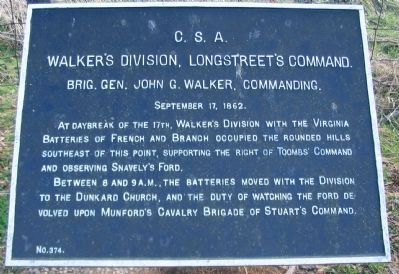
Walker's Division, Longstreet's Command
Walker's Division, Longstreet's Command
Brig. Gen. John G. Walker, Commanding.
September 17, 1862.
At daybreak of the 17th, Walker's Division with the Virginia Batteries of French and Branch occupied the rounded hills southeast of this point, supporting the right of Toombs' Command and observing Snavely's Ford.
Between 8 and 9 a.m., the batteries moved with the Division to the Dunkard Church, and the duty of watching the ford devolved upon Munford's Cavalry Brigade of Stuart's Division.
Erected by Antietam Battlefield Board. (Marker Number 374.)
Topics and series. This historical marker is listed in this topic list: War, US Civil. In addition, it is included in the Antietam Campaign War Department Markers series list. A significant historical month for this entry is September 1862.
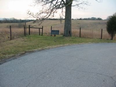
Location. Marker has been reported missing. It was located near 39° 26.772′ N, 77° 44.516′ W. Marker was near Sharpsburg, Maryland, in Washington County. Marker was on Branch Avenue, on the left when traveling south. Located where Branch Avenue turns to the west on the park tour. Touch for map. Marker was in this post office area: Sharpsburg MD 21782, United States of America. Touch for directions.
Other nearby markers. At least 8 other markers are within walking distance of this location . Jackson's Command (about 500 feet away, measured in a direct line); Battery A, 5th U.S. Artillery (about 600 feet away); Battery G, 4th U.S. Artillery (about 600 feet away); Battery E, 2nd U.S. Artillery (about 600 feet away); Battery E, 4th U.S. Artillery (about 600 feet away); Ninth Army Corps (about 600 feet away); Brigadier General L. O'B. Branch (about 700 feet away); Rodman's Division, Ninth Army Corps (about 700 feet away). Touch for a list and map of all markers in Sharpsburg.
Also see . . .
1. Antietam Battlefield. National Park Service site. (Submitted on March 30, 2008, by Craig Swain of Leesburg, Virginia.)
2. Walker's Division, Longstreet's Command. In his official report, Walker described his position here, My batteries were placed on commanding heights in such way as to command the roads leading from the east, while a battalion of sharpshooters was posted along the wooded banks of the Antietam, to hold the enemy in check should he attempt to cross the stream at that point. While we were in this position, the enemy made no attempt to cross the stream, and the only evidence of his being in our front was his artillery fire at long range and the reply of General Toombs' batteries, about half a mile to my left. (Submitted on March 30, 2008, by Craig Swain of Leesburg, Virginia.)
3. Storm Damage. This marker was one of two damaged in a storm that passed through the battlefield on June 4, 2008. (Submitted on June 8, 2008, by Craig Swain of Leesburg, Virginia.)

Photographed By Craig Swain, March 29, 2008
3. Watching Snavely's Ford
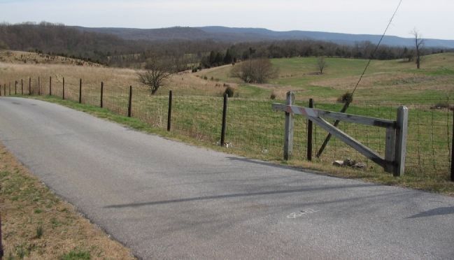
Looking southeast from the southern boundary of the park. Ransom's Brigade held the bald ridge spur in the center distance supporting Branch's Battery covering Snavely's Ford. The ford over the Antietam is at the bottom of the ravine passing through the center of this photo. When Walker's Division moved, this area was mostly unoccupied, leaving a gap in the Confederate defenses.
Credits. This page was last revised on December 7, 2017. It was originally submitted on March 30, 2008, by Craig Swain of Leesburg, Virginia. This page has been viewed 1,113 times since then and 40 times this year. Photos: 1, 2, 3. submitted on March 30, 2008, by Craig Swain of Leesburg, Virginia.

