Scranton in Lackawanna County, Pennsylvania — The American Northeast (Mid-Atlantic)
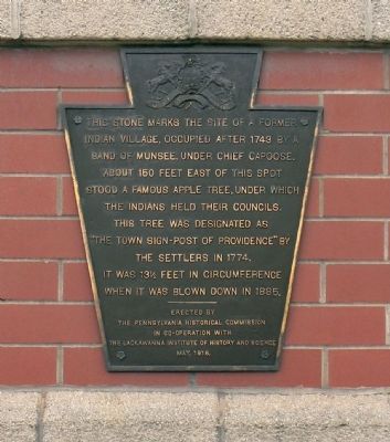
Munsee Indian Village
Erected 1916 by Pennsylvania Historical Commission in co-operation with the Lackawanna Institute of History and Science.
Topics and series. This historical marker is listed in this topic list: Native Americans. In addition, it is included in the Pennsylvania Historical and Museum Commission series list. A significant historical year for this entry is 1743.
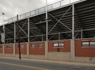
Location. 41° 25.189′ N, 75° 39.927′ W. Marker is in Scranton, Pennsylvania, in Lackawanna County. Marker is on Providence Road, 0.2 miles north of Olive Street. The marker is now affixed an exterior wall on the street side of Memorial Stadium. Touch for map. Marker is at or near this postal address: 801 Providence Road, Scranton PA 18508, United States of America. Touch for directions.
Other nearby markers. At least 8 other markers are within walking distance of this marker. Memorial Stadium (about 300 feet away, measured in a direct line); War Memorial (about 600 feet away); Lackawanna River Watershed History (approx. 0.2 miles away); The Electric City (approx. ¼ mile away); Weston Field and Field House (approx. 0.3 miles away); Reddington Field (approx. 0.3 miles away); Capoose (approx. 0.4 miles away); Miners and Laborers Memorial (approx. 0.4 miles away). Touch for a list and map of all markers in Scranton.
More about this marker. The present day location of the apple tree would among the industrial buildings on the east side of Providence Road.
Credits. This page was last revised on June 16, 2016. It was originally submitted on August 18, 2013, by PaulwC3 of Northern, Virginia. This page has been viewed 916 times since then and 61 times this year. Photos: 1, 2. submitted on August 18, 2013, by PaulwC3 of Northern, Virginia.

