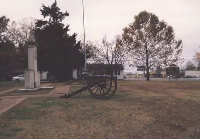
Tupelo in Lee County, Mississippi — The American South (East South Central)
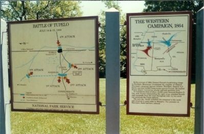
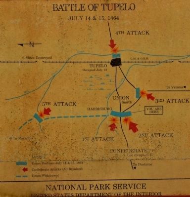
Battle of Tupelo
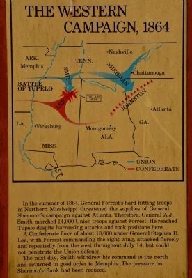
The Western Campaign, 1864
In the summer of 1864, General Forrest's hard hitting troops in Northern Mississippi threatened the supplies of General Sherman's campaign against Atlanta. Therefore, General A. J. Smith marched 14,000 Union troops against Forrest. He reached Tupelo despite harassing attacks and took positions here. A Confederate force of about 10,000 under General Stephen D. Lee, with Forrest commanding the right wing, attacked fiercely and repeatedly from the west throughout July 14, but could not penetrate the Union defense. The next day, Smith withdrew his command to the north and returned in good order to Memphis. The pressure on Sherman's flank had been reduced.
Erected by National Park Service, U.S. Department of the Interior.
Topics. This historical marker is listed in this topic list: War, US Civil. A significant historical date for this entry is July 14, 1862.
Location. 34° 15.336′ N, 88° 44.207′ W. Marker is in Tupelo, Mississippi, in Lee County. Marker is at the intersection of West Main Street (U.S. 278) and Monument Drive, on the right when traveling east on West Main Street. Touch for map. Marker is in this post office area: Tupelo MS 38804, United States of America. Touch for directions.
Other nearby markers. At least 8 other markers are within 2 miles of this marker, measured as the crow flies. A different marker also named Battle of Tupelo (within shouting distance of this marker); Battle of Ackia (approx. 0.9 miles away); Lee County Library (approx. 1˝ miles away); John E. Rankin (approx. 1˝ miles away); Robins Field / High School Football During Segregation (approx. 1.6 miles away); Chickasaw Village Site (approx. 1.6 miles away); In Commemoration of Hernando De Soto (approx. 1.6 miles away); Tupelo Baptist Church / Kind Treatment for the Wounded (approx. 1.6 miles away). Touch for a list and map of all markers in Tupelo.
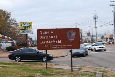
Regarding Battle of Tupelo. Tupelo National Battlefield (NB) is a one-acre monument located on Main Street, Tupelo, Mississippi. Main Street in Tupelo is also known as Highway 6 and Highway 278. Tupelo NB sits on the south side of Main Street on the west side of Tupelo. Exit off the Natchez Trace Parkway onto Highway 6 (near Milepost 260), head east, into Tupelo. Travel one mile east and find Tupelo NB on the right side of Main Street. There is limited parking available adjacent to the monument.
Related markers. Click here for a list of markers that are related to this marker. Battle of Tupelo by Markers.
Also see . . .
1. Tupelo Battlefield. National Park Service website entry (Submitted on March 31, 2008, by Mike Stroud of Bluffton, South Carolina.)
2. The Battle of Tupelo. Explore Southern history website entry:
Fought within the limits of the modern city of Tupelo, the critical engagement helped assure the success of Sherman's Atlanta Campaign by diverting the attention of the Confederacy's "Wizard of the Saddle," Nathan Bedford Forrest. (Submitted on January 21, 2013, by Mike Stroud of Bluffton, South Carolina.)
Additional keywords. USCT, U.S. Colored Troops
Credits. This page was last revised on June 22, 2022. It was originally submitted on March 31, 2008, by Mike Stroud of Bluffton, South Carolina. This page has been viewed 2,180 times since then and 45 times this year. Photos: 1. submitted on March 30, 2008, by Mike Stroud of Bluffton, South Carolina. 2, 3. submitted on July 24, 2015, by Karl Stelly of Gettysburg, Pennsylvania. 4. submitted on September 27, 2015, by Brandon Fletcher of Chattanooga, Tennessee. 5. submitted on June 18, 2008, by Richard E. Miller of Oxon Hill, Maryland. • Craig Swain was the editor who published this page.
