West Ashley in Charleston in Charleston County, South Carolina — The American South (South Atlantic)
Mixed Results
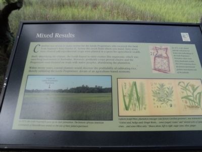
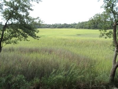
Carolina was meant to make money for the Lords Proprietors who received this land from England’s King Charles II. Across the creek from where you stand, forty acres were cleared and experimental crops were planted in a quest for agricultural wealth.
Badly misjudging the climate, the Lords hoped to raise exotics like sugarcane, which was enriching landowners in Barbados. However, profitable crops proved elusive and the Proprietors soon focused on trade with native peoples, abandoning the plantation.
Within twenty years, coastal planters would discover the profitability of cultivating rice, thereby validating the Lords Proprietors’ dream of an agriculture-based economy.
( Sidebar : )
Next to a diagram of the plantation and palisade wall: By 1671, a star-shape palisade wall protected homes and outbuildings of the Lords Proprietors’ Plantation where some thirty farmhands worked. This 1673 rendering shows the formal experimental gardens immediately east of the palisade.
Topics. This historical marker is listed in these topic lists: Colonial Era • Settlements & Settlers. A significant historical year for this entry is 1671.
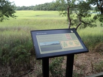
Location. 32° 48.101′ N, 79° 59.053′ W. Marker is in Charleston, South Carolina, in Charleston County. It is in West Ashley. Marker can be reached from Old Town Plantation Road. Marker is located on the History Trail at Charles Towne Landing. Touch for map. Marker is at or near this postal address: 1500 Old Towne Road, Charleston SC 29407, United States of America. Touch for directions.
Other nearby markers. At least 8 other markers are within walking distance of this marker. Ship Shaping (about 400 feet away, measured in a direct line); Seized! (about 400 feet away); Harnessing the Wind (about 400 feet away); The Adventure, Trading Ketch (about 400 feet away); Seeking Wealth, Sowing Servitude (about 500 feet away); On the Edge of an Empire (about 500 feet away); Buildings “All of Wood”? (about 500 feet away); Trade, Profits and Support (about 500 feet away). Touch for a list and map of all markers in Charleston.
More about this marker. A photo at the lower left of the marker indicates the “Vicinity of Lords Proprietors’ Plantation” and has a caption of “In 1675, the Lords Proprietors gave up on their plantation. The historic African-American community of Maryville now stands on the site of their failed experiment.”
The lower right of the marker contains a picture of several crops that were intended to be grown at the settlement. It includes the caption “Captain Joseph West, plantation manager (and future Carolina governor), was instructed to plant ‘Cotton seed, Indigo seed, Ginger Roots, . . . some [sugar] cane and several sorts of [grape] vines . . . and Ollive setts.’ Shown above, left to right: sugar cane, olive, ginger.”
Credits. This page was last revised on February 16, 2023. It was originally submitted on August 19, 2013, by Bill Coughlin of Woodland Park, New Jersey. This page has been viewed 412 times since then and 10 times this year. Photos: 1, 2, 3, 4. submitted on August 19, 2013, by Bill Coughlin of Woodland Park, New Jersey.


