Marker Logo HMdb.org THE HISTORICAL
MARKER DATABASE
“Bite-Size Bits of Local, National, and Global History”
Near Grover in Weld County, Colorado — The American Mountains (Southwest)
 

Corner Common to Nebraska and Wyoming on the Colorado State Boundary


Corner Common to Nebraska and Wyoming Marker image. Click for full size.
Photographed By Duane Hall, July 7, 2013
1. Corner Common to Nebraska and Wyoming Marker
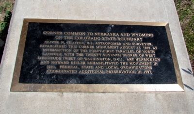
Inscription. Oliver N. Chaffee, U.S. astronomer and surveyor, established this corner monument August 17, 1869, at intersection of the forty-first parallel of north latitude with the twenty-seventh degree of west longitude (west of Washington, D.C.). Art Henrickson and Howard Kieler rehabilitated the monument in 1981. Federal, state and local organizations coordinated additional preservation in 1997.
 
Topics. This historical marker is listed in this topic list: Science & Medicine. A significant historical year for this entry is 1869.
 
Location. 41° 0.098′ N, 104° 3.198′ W. Marker is near Grover, Colorado, in Weld County. Marker can be reached from Weld County Road 105, 1.7 miles north of Weld County Road 136, on the right when traveling north. Marker is also accessible from the north on Laramie County Road 164 approx. 2.5 miles south of Laramie County Road 203. Marker is a 1/2 mile from the county road. A pasture road from the county road along the fence line / State boundary will take you to the marker. However, the pasture road is rough, and you may park your vehicle on the county road and walk to the marker. Touch for map. Marker is in this post office area: Grover CO 80729, United States of America. Touch for directions.
 
Other nearby markers. At least 3 other markers are within 13 miles of this marker, measured as the crow flies. Panorama Point (approx. 1.2 miles away in Nebraska); Geology Shaping History
Paid Advertisement
Click on the ad for more information.
Please report objectionable advertising to the Editor.
Click or scan to see
this page online
(approx. 12 miles away in Wyoming); Old Texas Trail (approx. 12.6 miles away in Wyoming).
 
More about this marker. The marker is on private land but is open to the public. Please respect the owner's property and cattle operation.
 
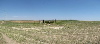
Corner Common to Nebraska and Wyoming Marker image. Click for full size.
Photographed By Duane Hall, July 7, 2013
2. Corner Common to Nebraska and Wyoming Marker
The fence line to the left of the marker is the state line between Wyoming and Colorado. The fence line to the right of the marker is the state line between Wyoming and Nebraska.
Marker and Corner Survey Stone image. Click for full size.
Photographed By Duane Hall, July 7, 2013
3. Marker and Corner Survey Stone
Corner Survey Stone image. Click for full size.
Photographed By Duane Hall, July 7, 2013
4. Corner Survey Stone
View from the north
 
 
Credits. This page was last revised on October 29, 2020. It was originally submitted on August 24, 2013, by Duane Hall of Abilene, Texas. This page has been viewed 1,157 times since then and 219 times this year. Photos:   1, 2, 3, 4. submitted on August 24, 2013, by Duane Hall of Abilene, Texas.
Share this page.  
Share on Tumblr
m=68071

CeraNet Cloud Computing sponsors the Historical Marker Database.
This website earns income from purchases you make after using our links to Amazon.com. We appreciate your support.
Paid Advertisement
Apr. 25, 2024